


December 07, 2015
El Nino continues to cook to very strong levels and could blow RECORD HIGH temperatures our way by next weekend.
I must admit there aren't too many occasions when you can dine al fresco on a December night in Philly, but if you were out and about this past Saturday night in the city of Philadelphia, the sidewalks were filled with people, pasta, pizza and vino.
Don't worry if you missed it, you look to have another chance this coming weekend, so make your reservations early as it looks like record warmth is heading our way. To all the restaurateurs who had a bite (pun intended) taken out of their profits during the Pope's visit, you have a new savior: a powerful El Nino.
RELATED: John Bolaris' long-range winter weather outlook
The combination of a strong El Nino, a positive North Atlantic oscillation (NAO) and Arctic oscillation (AO) will keep the Arctic air locked mainly north of the border, with the best chances of snow over the next 10 days across the upper Midwest.
Temperatures for us all this week will continue to be unseasonably mild with readings mainly in the 50s. As we move into the upcoming weekend, however, a very strong ridge of high pressure will lock in, with its clockwise flow sending near-record or record-breaking temperatures our way.
A few places this weekend, away from the shore, will see the mercury head toward the 70-degree mark.
Now before you swap your snow shovel for sunblock this winter, I do see some significant changes toward much colder temperatures and possible storminess along the East Coast as we move into Christmas week. Long-range ensemble models are hinting at a sharp drop into the negative phase for the AO, and neutral to negative for NAO. Will keep you posted.
In the meantime, it's al fresco December!!!
Monday: Sweet sunshine, 56
Tuesday: Bit cooler, 50
Wednesday: Clouds shroud, 52
Thursday: AM shower, 55
Friday: Few drops/mild, 61
Saturday: Warm, 65
Sunday: Warm, 68
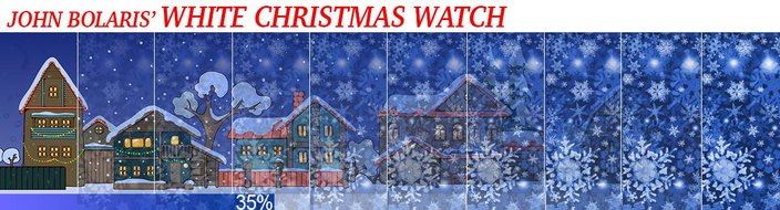
As we rapidly close in on the holidays, it's a good time to keep you updated on the possibility of a white Christmas.
Technically, a white Christmas means at least one inch or more of snow on the ground on Christmas Day.
In any given year we stand about a 25 percent chance of seeing an inch or more of snow on the ground come December 25th.
Right now the odds certainly don't favor a white Christmas, however medium- and long-range models are hinting at perhaps a more uncertain Christmas week with colder temperatures and maybe some East Coast cyclogenesis.
With that being said, I will inch up Philly's chances for a white Christmas to about 35 percent.