


February 19, 2019
 Thom Carroll/PhillyVoice
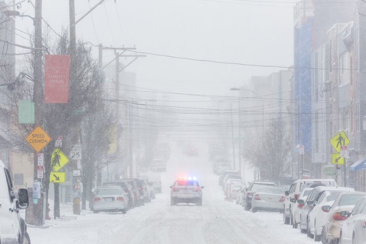
A Philadelphia police car travels south along 2nd Street in Northern Liberties during Thursday's windy snowstorm.
The western suburbs of Philadelphia are under a winter storm warning ahead of Wednesday's snowfall.
Snow accumulations of 2-4 inches and a light glaze of ice are expected in Chester County and western Montgomery County, according to National Weather Service forecasters. The warning will be in effect from 10 a.m. Wednesday to 1 a.m. Thursday.
A winter weather advisory has been declared in Philadelphia, Delaware County, eastern Montgomery County and Lower Bucks County, from 7 a.m. to 9 p.m. Wednesday, forecasters said. Snow accumulations of 2-4 inches and a light glaze of ice are expected across that area as well.
Slippery, hazardous road conditions could impact the evening commute.
Forecasters say they have relatively high confidence the precipitation will begin as snow. With the arrival of a warm front, the precipitation type becomes less certain, but the snow should begin a transition to sleet. Though there is a threat of freezing rain if there is more warming.
There is considerable uncertainty still with snow and ice accumulations that are dependent on the timing of changeovers.
Here is the 7-day forecast for Philadelphia from the weather service:
Tuesday night: Increasing clouds, with a low around 26. Northwest wind around 5 mph becoming calm in the evening.
Wednesday: Snow, mainly after 10 a.m. High near 35. East wind 5 to 8 mph. Chance of precipitation is 90 percent. New snow accumulation of 2 to 4 inches possible.
Wednesday night: Rain and sleet, possibly mixed with freezing rain before 7 p.m., then rain and sleet till 10 p.m., then rain afterwards. Low around 34. East wind 6 to 8 mph. Chance of precipitation is 90 percent. Little or no ice accumulation expected. New sleet accumulation of less than a half inch possible.
Thursday: Rain, mainly before 7 a.m. High near 55. West wind 5 to 11 mph. Chance of precipitation is 80 percent. New precipitation amounts of less than a tenth of an inch possible.
Thursday night: Mostly cloudy, with a low around 33. Northwest wind 6 to 10 mph.
Friday: Partly sunny, with a high near 47.
Friday night: Mostly cloudy, with a low around 32.
Saturday: A chance of rain. Mostly cloudy, with a high near 46. Chance of precipitation is 50 percent.
Saturday night: Rain likely. Cloudy, with a low around 38. Chance of precipitation is 70 percent.
Sunday: Rain likely. Mostly cloudy, with a high near 56. Chance of precipitation is 70 percent.
Sunday night: Mostly cloudy, with a low around 38.
Monday: Mostly sunny, with a high near 50.
Monday night: Mostly clear, with a low around 31.
Tuesday: Mostly sunny, with a high near 46.