


February 15, 2018
 Thom Carroll, File/PhillyVoice
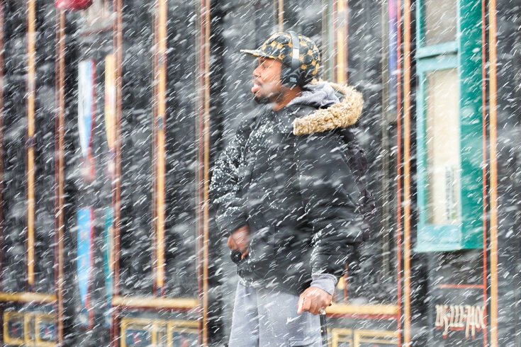
A man waits to cross the street in heavy snow on March 10, 2017 in Philadelphia.
The Philadelphia region will see more rain and mild temperatures on Friday, but wintry weather looks to set in over the long President's Day weekend.
Precipitation is likely, but weather models do not agree on the track of the storm nor the temperatures of the lower atmosphere, according to the National Weather Service.
Still, snow is likely to begin Saturday night.
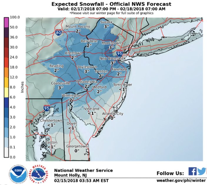
In what they termed a "conservative" forecast because its uncertainty at this point, meteorologists see as much as 3 inches of snow in Philadelphia, Trenton and the far north and west cities of Reading and Allentown.
In between, in places like Coatesville, Chester County to Norristown, Montgomery County to Doylestown, Bucks County, as much as 4 inches of snow is expected.
(Some models show the possibility of locally-higher amounts but for now there is low confidence in that scenario.)
Far South Jersey and the Jersey Shore will see less than inch and perhaps no accumulation by the time the fast-moving storm moves out.
The precipitation should end by sunrise on Sunday, which looks to be otherwise dry.
Temperatures are expected to rise again for the start of the workweek, with showers or a period of rain on Monday and perhaps Tuesday, meteorologists say.
Temperatures on Tuesday and Wednesday could set records for the date with highs expected to approach 70.
Here is the 7-day forecast for Philadelphia from the weather service:
Thursday afternoon: A chance of showers after 5 p.m. Mostly cloudy, with a high near 63. Southwest wind around 9 mph. Chance of precipitation is 30 percent.
Thursday night: A chance of showers before 7 p.m., then rain after. Low around 56. Southwest wind 8 to 14 mph. Chance of precipitation is 90 percent. New precipitation amounts between a quarter and half of an inch possible.
Friday: Rain likely before 1 p.m., then a slight chance of showers till 4 p.m. Cloudy, with a temperature falling to around 49 by 5 p.m. Northwest wind 8 to 16 mph, with gusts as high as 26 mph. Chance of precipitation is 70 percent. New precipitation amounts of less than a tenth of an inch possible.
Friday night: Partly cloudy, with a low around 29. Northwest wind 7 to 14 mph, with gusts as high as 24 mph.
Saturday: A chance of rain after 4 p.m. Mostly sunny, with a high near 39. Calm wind becoming southeast 5 to 7 mph in the morning. Chance of precipitation is 30 percent. New precipitation amounts of less than a tenth of an inch possible.
Saturday night: Rain and snow, becoming all snow after 10 p.m. Low around 31. Chance of precipitation is 90 percent. New precipitation amounts between a quarter and half of an inch possible.
Sunday: A chance of snow before 7 a.m. Mostly sunny, with a high near 48. Chance of precipitation is 30 percent.
Sunday night: Partly cloudy, with a low around 32.
Washington's Birthday: A chance of rain. Mostly cloudy, with a high near 53. Chance of precipitation is 40 percent.
Monday night: A chance of showers. Cloudy, with a low around 47. Chance of precipitation is 40 percent.
Tuesday: A chance of showers. Mostly cloudy, with a high near 65. Chance of precipitation is 30 percent.
Tuesday night: Mostly cloudy, with a low around 52.
Wednesday: A chance of showers. Mostly cloudy, with a high near 65. Chance of precipitation is 30 percent.
Wednesday night: A chance of showers. Mostly cloudy, with a low around 46. Chance of precipitation is 30 percent.
Thursday: A chance of showers. Partly sunny, with a high near 56.