


October 03, 2015
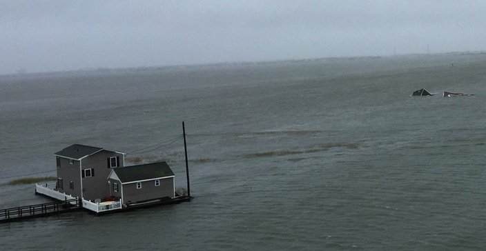
 Credit/Frank Phifer
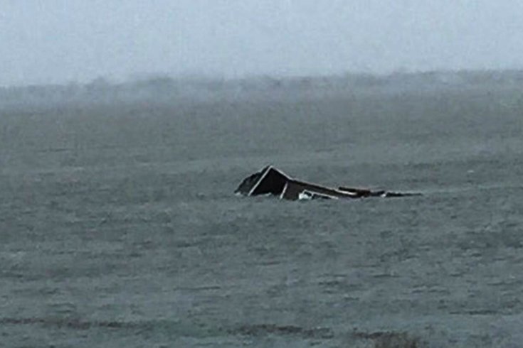
A home sits submerged in the bay off Wildwood as the effects of Hurricane Joaquin are felt at the Jersey Shore.
Maybe we were blessed by the pope, but thank God that Joaquin defied 98 percent of computer consensus and is heading out to sea.
Hurricane Joaquin is now a hurricane of catastrophic strength, with winds sustained of 155mph, gusting close to 200mph, officially a Cat 4.
PREVIOUS COVERAGE: Bolaris: We dodged a Sandy-like bullet with Joaquin
Right now Bermuda is feeling a tremendous amount of trepidation as hurricane watches have been posted as Joaquin's track will come very close to striking the island. The latest track keeps it just west by 65 miles, which is simply too close to call at this time, especially since its track has been erratic.
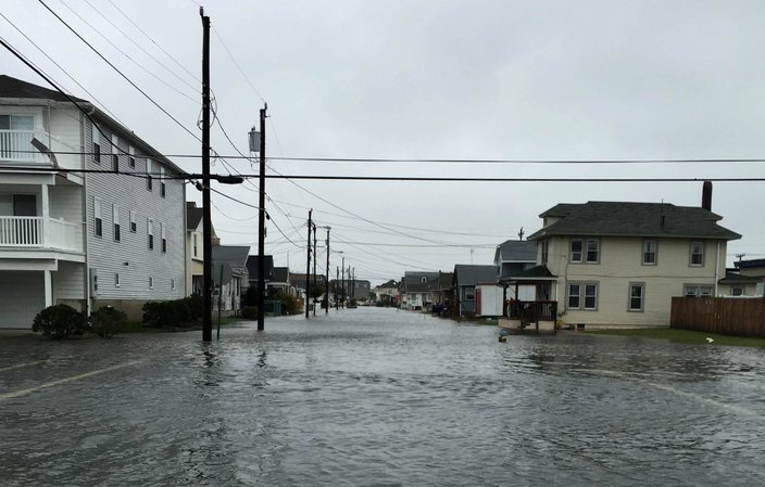
The combination of very strong high pressure to the north and powerful Joaquin to the south is producing a very tight pressure gradient, which is funneling the Atlantic Ocean toward the shore. As a result, it is producing major flooding and causing very significant property damage along our southern New Jersey shore towns.
In North Wildwood, bayside homes are flooded, and at least one home has been swept out into the bay. Serious flooding will continue to take place during the multiple high tide cycles throughout the weekend. The big problem? The back bays are backing up as they are unable to fully empty between high tide cycles due to the generating easterly push being produced by Joaquin and high pressure to the north.
This phenomenon will not relax until sometime on Monday, but even then I'm still anticipating at least minor-to-moderate flooding.
The hurricane will pass hundreds of miles off the Jersey shore by Monday afternoon, and then finally the flooding tide cycle will cease.
Joaquin is currently located about 500 miles southwest of Bermuda, moving northeast at 17mph, with sustained winds fluctuating between 150-155mph.
• • •
The National Weather Service forecasts for Philadelphia and the Jersey Shore:
Philadelphia
Saturday: Rain or drizzle likely. Cloudy, with a high near 62. Breezy, with a northeast wind around 21 mph. Chance of precipitation is 60 percent.
Saturday night: Chance of light rain or drizzle. Cloudy, with a low around 60. Breezy. Chance of precipitation is 40 percent.
Sunday: Chance of rain. Cloudy, with a high near 68. Chance of precipitation is 40 percent.
Sunday night: Rain likely. Mostly cloudy, with a low around 61. Chance of precipitation is 30 percent.
Monday: Chance of showers. Mostly cloudy, with a high near 70. Chance of precipitation is 30 percent.
Monday night: Mostly cloudy, with a low around 57.
Jersey Shore
Saturday: Rain or drizzle likely. Cloudy, with a high near 68. Windy, with a northeast wind around 30 mph, with gusts as high as 50 mph. Chance of precipitation is 70 percent.
Saturday night: Chance of rain or drizzle. Cloudy, with a low around 65. Windy. Chance of precipitation is 50 percent.
Sunday: Chance of rain. Cloudy, with a high near 69. Breezy. Chance of precipitation is 40 percent.
Sunday night: Chance of rain. Mostly cloudy, with a low around 64. Breezy. Chance of precipitation is 40 percent.
Monday: Chance of showers. Mostly cloudy, with a high near 70. Windy. Chance of precipitation is 40 percent.
Monday night: Mostly cloudy, with a low around 60.