


February 09, 2016
 Matt Rourke, File/AP
Below freezing temperatures and rough winds are forecast for Saturday and Sunday.
OK, so the snowstorm was a bit of a bust, but don't celebrate yet: Mother Nature has something else in store for us.
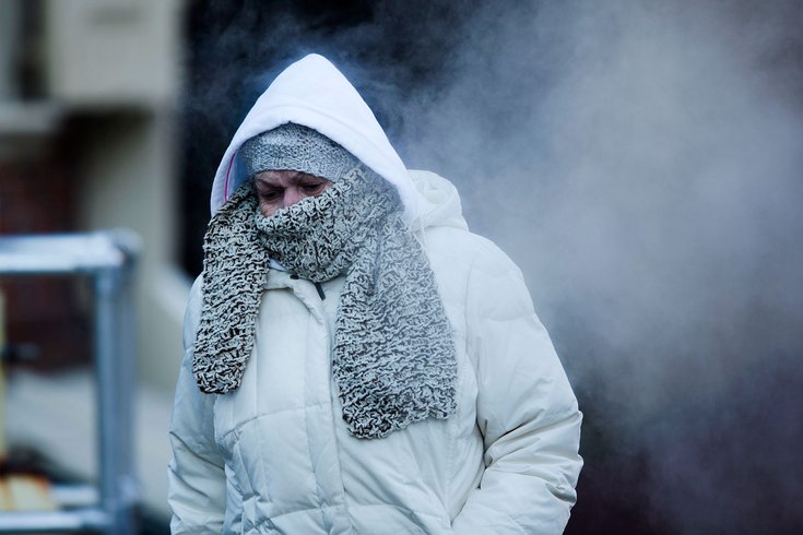
Get ready to bundle up. It's going to get cold. Ve-r-r-r-y cold.
An Arctic blast will blow into the region in two waves beginning Thursday, forecasters said.
The first cold front is expected to move through on Wednesday night, with a second front following sometime Friday night into Saturday, the National Weather Service said.
.
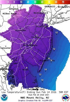
On Sunday morning, however, the polar invasion will force real temperatures as low as 1 degree.
It gets worse.
Winds in the 20-30 mph range will plunge the wind chill on Sunday morning as low as -14 degrees, coldest in north and west of the city, forecasters said.
The low temperature so far this season was 12 degrees, and the record low for Feb. 14 (Sunday) is 2 degrees in 1979.
The bright side? There is little chance of any major precipitation through the weekend.
A Cold Blue weather emergency is in effect through 9 a.m. Monday in Montgomery County to alert residents that winter conditions pose a threat of serious harm or death to individuals without shelter.
In Camden County, officials have declared a Code Blue from 6 p.m. Tuesday until 7 a.m. Wednesday, and again from 6 p.m. Wednesday to 7 a.m. Thursday.
Other counties can be expected to declare similar cold weather emergencies as the weekend nears.
People are encouraged to take precautions to stay warm for the duration of the cold snap.
Here's the forecast through the weekend:
Tonight
Scattered snow showers, mainly between 9 p.m. and 4 a.m. Mostly cloudy with a low around 23. West wind 13 to 16 mph. Chance of precipitation is 30 percent. Total nighttime snow accumulation of less than a half inch possible.
Thursday
Partly sunny, with a high near 28. Breezy, with a west wind 15 to 23 mph.
Thursday Night
Mostly clear, with a low around 14. West wind 7 to 17 mph.
Friday
Mostly sunny, with a high near 28. Southwest wind 6 to 9 mph.
Friday Night
A chance of snow showers. Mostly cloudy, with a low around 18. West wind 6 to 13 mph. Chance of precipitation is 30 percent. New snow accumulation of less than a half inch possible.
Saturday
Scattered flurries. Partly sunny, with a high near 19. Blustery.
Saturday Night
Partly cloudy, with a low around 2. Blustery.
Sunday
Sunny, with a high near 16.
Sunday Night
Partly cloudy, with a low around 12.
Monday
A chance of snow. Mostly cloudy, with a high near 36. Chance of precipitation is 30 percent.
Monday Night
A chance of rain and snow. Mostly cloudy, with a low around 33. Chance of precipitation is 50 percent.