


March 12, 2015
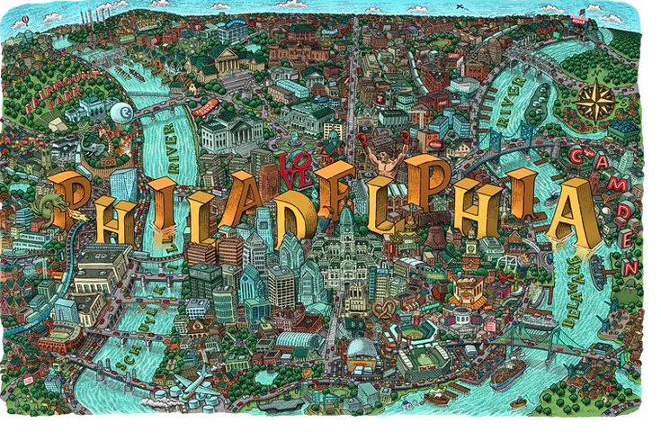 Artist Mario Zucca/Twitter
Illustrated map of Philly, featuring every important landmark and building in the city.
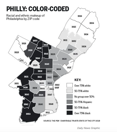
Philadelphia’s one of the most racially segregated metro areas in America, ranked ninth according to the 2010 Census.
A recent study by Harvard sociologist Jackelyn Hwang focused on Philly’s racial divide – aka gentrification – and found that blacks and whites define and identify with the city’s changing neighborhoods very differently.
To conduct the study, Hwang interviewed 56 residents living between South and Washington, Broad and the Schuylkill – 26 black, 26 white and four mixed-race – and asked them to draw mental maps of their neighborhood, name it and explain why they constituted the boundaries the way they did.
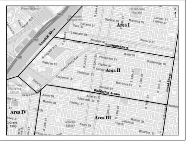
Her findings, which were reported by Philadelphia Magazine, found that all of the residents who defined the neighborhood in the broader spatial context were African-American or mixed-race; practically everyone who defined it in the latter context were white.
Black residents defined the neighborhood as a large and inclusive spatial area, using a single name (South Philly) and conventional boundaries, invoking the area’s black cultural history, whereas white residents saw their neighborhood as “smaller, and used a number of names (Broad, Gray's Ferry and Oregon, for example) and more unconventional boundaries.
The latter group also used these boundaries to delineate between their neighborhood and areas they saw as low-income or high crime.
Read the full Philadelphia Magazine article here.