


January 03, 2024
 Thom Carroll/for PhillyVoice
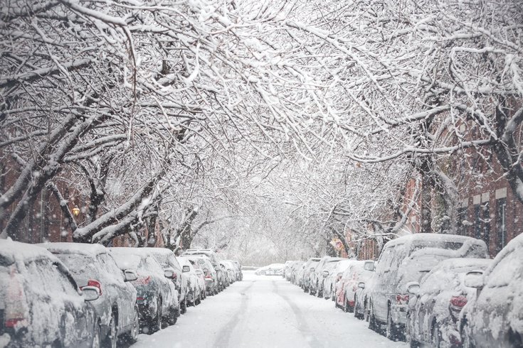
Don't expect anywhere in the Delaware Valley to look like this photo this weekend. The latest forecast is that the winter storm moving to the region Saturday and Sunday will bring a wintry mix of mostly rain. It has been nearly two years since it snowed more than 1 inch in Philly.
Could Philly's record-breaking snow drought end this weekend?
A Nor'easter storm system making its way north is expected to bring snow, rain and winds to the region Saturday and Sunday, according to the National Weather Service. And while it's possible that Philly could see enough snow to break its nearly two-year snow drought, meteorologists now predict a wetter, wintery mix for the Philadelphia region this weekend.
MORE: Chestnut Street bridge over I-95 scheduled to close Jan. 15 ahead of demolition
“We don't expect the totals in our area to be very great,” said Patrick O’Hara, a meteorologist with the National Weather Service in Mount Holly, New Jersey. “It will probably start precipitating, starting with snow and then turn to rain. If anything accumulates it'll probably melt.”
More substantial snowfall forecast for northeastern Pennsylvania near the Poconos and potentially to the Lehigh Valley, where the NWS says the snow may turn into sleet or rain by Saturday evening. In Philadelphia and South Jersey, things will be even wetter and may even lead to some coastal flooding.
⚠️❄️ A coastal system will bring widespread precipitation to our region. Snow and some mixed precip will occur northwest of I-95. The immediate urban corridor is unlikely to experience anything more than a wet coating of snow.https://t.co/JiD09ByGTv#PAwx #NJwx #DEwx #MDwx pic.twitter.com/LdbaspdfxS
— NWS Mount Holly (@NWS_MountHolly) January 4, 2024
The region last saw a significant amount of snow – that is, at least one inch of total accumulation – on Jan. 29, 2022, according to the NWS. That storm dumped a total of 7 1/2 inches of snow in Philadelphia and 16 inches in Atlantic City. The skies above the Delaware Valley have been virtually snow-free ever since.
The next time Philly gets an inch of snow be the first time that’s happened in more than 700 days. That's a record for the longest stretch without snow in the city, recently surpassing a stretch that ended in 1973.
Once the precipitation starts falling –whenever that may be – NWS observers will take periodic measurements using the decidedly low-tech method of sticking a wooden measuring stick into the snow at select locations across the region.
"You try to do the best you can," O'Hara said of the measurement process. "Sometimes the wind is blowing a lot."
If the snowfall clocks in at one-tenth of an inch or more, the NWS considers it a "measurable" amount of snow. At one inch, the snowfall would break Philly's nearly two-year-long streak – even if the rain quickly melts it away.
Even if it doesn't happen this weekend, the city's snow drought could end this winter because experts are forecasting 2023-2024's storms to bring a total of about 25 inches of snow in between some unseasonably warm moments, according to predictive models from PA Weather Action. The same model predicts as much as 83 inches of snow in Susquehanna County, in the northeastern corner of the state, and 120 inches in parts of southwestern Pennsylvania.
Initially, it looked like this weekend's storm would be the first significant snowfall of the season. While the Saturday's precipitation could technically break the snowless streak before the rain kicks in, anyone hoping to build a snow fort or sled down the Art Museum steps will likely be out of luck.
“If you like the snow, you don't have to go very far, because up in the Poconos they will probably have snow," O'Hara said. "Maybe even in Allentown and the Lehigh Valley. You could go up on Saturday morning and see it.”
This is the latest daily forecast for Philadelphia from the NWS.
Friday: Sunny, high temperature near 37 degrees.
Friday night: Increasing clouds, low around 28.
Saturday: Rain and snow, mainly after 1 p.m. High near 40. Chance of precipitation is 90%. New snow accumulation of less than a half inch possible.
Saturday night: Rain and snow before 10 p.m., rain between 10 p.m. and 1 a.m., then a chance of rain and snow after 1 a.m. Low around 34. Breezy. Chance of precipitation is 100%. New precipitation amounts between 1/2 and 3/4 of an inch possible.
Sunday: Chance of rain an snow before 4 p.m.. Mostly cloudy, high temperature near 39 degrees. Chance of precipitation is 50%.
Sunday night: Partly cloudy, low around 30 degrees.
Monday: Sunny, high near 42