


January 16, 2024
 Michaela Althouse/PhillyVoice
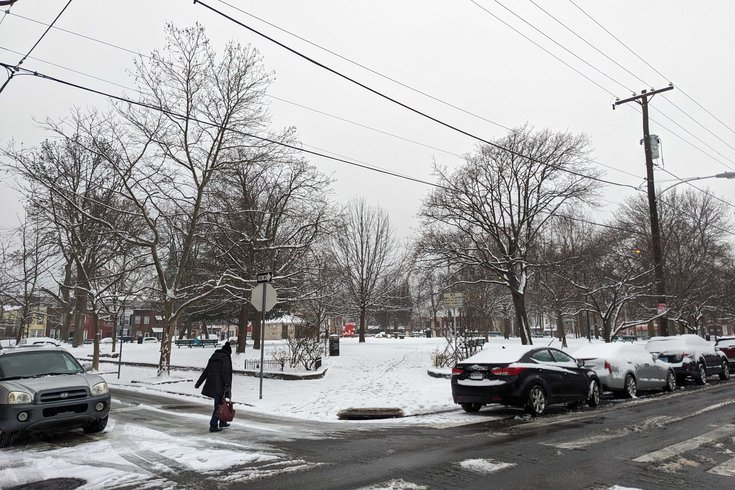
Philadelphia received its first significant snowfall in nearly two years Monday night. Above, snow blankets Campbell Square in Port Richmond on Tuesday morning.
Philadelphia's snow drought is officially over.
About 1 1/2 inches fell on the city, beginning Monday night and continuing into Tuesday morning. A winter weather advisory is in effect until 1 p.m. in Philadelphia and Delaware counties and parts of Bucks, Chester and Montgomery counties. Conditions may cause commuting delays due to slick roads, and more snow is expected later in the week.
Philadelphia had gone 715 days without meaningful accumulation, the longest streak ever.
The wintery conditions Sunday, when temperatures in the region plunged below freezing, prompting a Code Blue advisory. Snowfall started Monday evening, and light freezing rain and snow are expected until early Tuesday afternoon. Initial forecasts predicted anywhere from 2 to 5 inches of snow.
As a result, PennDOT lowered the speed limit to 45 mph on I-95, I-295, I-76, I-476, I-276, as well as U.S. Routes 1, 30, 202, 422 and State Routes 63 and 309. PennDOT said it may lower speeds on other roads if conditions warrant it, but for now warned drivers to take it slow, avoid passing plow trucks and pack an emergency kit in their vehicles. According to 6ABC, about 100 trucks will be out to treat the roads to improve driving conditions.
The School District of Philadelphia continued to operate on a normal schedule, though the city's parochial schools closed. The Community College of Philadelphia opted to cancel classes before 10 a.m. Many other schools in the region, including some charter and private schools in the city, either closed or opened late.
Several Regional Rail trains, including those on the Airport, Chestnut Hill West, Fox Chase, Newark, Thorndale, Warminster and West Trenton lines, were operating on delays Tuesday morning, according to SEPTA.
More winter weather is on the way, with snow expected Friday around 1 a.m., according to the National Weather Service. Cold temperatures are expected to stay, with highs between 20 and 30 degrees forecasted all week.
The last time Philadelphia saw significant snowfall was Jan. 29, 2022, when the 7 1/2 inches hit the region, though there have been occasional dustings and bouts of freezing rain. In late 2023, the city broke the record for the longest "snow drought," surpassing a record set in 1973.
Here's the Philadelphia forecast from the National Weather Service, as of Tuesday morning:
Tuesday: Snow and freezing rain before 3 p.m., then a slight chance of snow before 4 p.m. High near 33. Chance of precipitation is 80%. Total daytime snow accumulation of less than a half inch possible. At night, mostly cloudy that gradually become mostly clear, with a low around 14.
Wednesday: Sunny, with a high near 25. A low around 20.
Thursday: Mostly cloudy, with a high near 34. At night, cloudy with a low around 26. Chance of precipitation is 30%. At night, a chance of snow, mainly after 1 a.m. Friday. Cloudy, with a low around 26. Chance of precipitation is 30%.
Friday: Snow likely during the day. Cloudy, with a high near 32. Chance of precipitation is 60%. At night, a chance of snow before 1 a.m.
Saturday: Mostly cloudy, with a low around 18. Chance of precipitation is 30%. Saturday: Partly sunny, with a high near 24. At night, mostly clear with a low around 16. Blustery.