


February 23, 2026
 Molly McVety/PhillyVoice
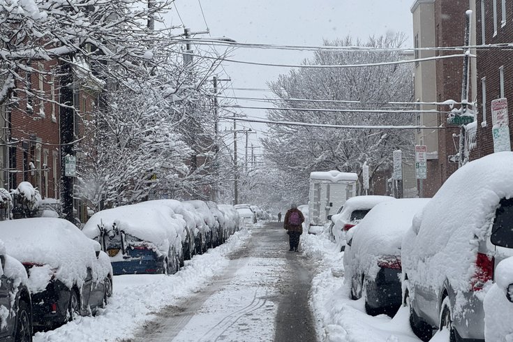
People were walking in the roads near the 1900 block of Catherine Street in South Philly on the morning of Feb. 23, 2026, after nearly 14 inches of snow fell overnight.
As Philadelphia digs out of its second major snowstorm this winter, meteorologists at the National Weather Service are working to determine whether the region experienced its first blizzard since 2016.
Nearly 14 inches of snow fell in Philly from Sunday to Monday, with parts of South Jersey getting up to 18 inches during the storm. The snow totals are among the highest in the last decade, but several conditions need to be met for a storm to count as a blizzard.
"You need to have at least three consecutive hours of one-quarter mile of visibility or less, falling or blowing snow, and frequent or sustained wind gusts of 35 mph or higher," said Alex Staarmann, a meteorologist at the National Weather Service's Mount Holly station.
The last time Philly had verified blizzard conditions was in January 2016, when more than 22 inches of snow fell at the airport. Before that, the most recent blizzard was the infamous 1996 storm that dumped more than 30 inches on the city. The storm that hit the region on Sunday was the first to trigger a blizzard warning since 2016.
"Traditionally, it's very difficult to get true blizzard conditions inland, primarily because the criteria are quite strict," Staarmann said. "It's a relatively rare phenomenon, at least on the East Coast."
Staarmann said it will take NWS several days to identify any locations in the region that saw blizzard conditions. That will involve reviewing photos, videos, wind observations and other measures of visibility from automated weather stations.
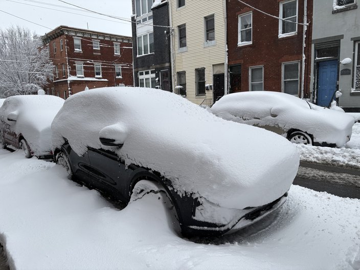
Many cars near 5th and Dickinson streets were still covered in snow around 10 a.m. Monday after a snowstorm blanketed the region.
So far, NWS has collected anecdotal evidence suggesting some areas experienced a blizzard. The hardest-hit places were in central and southern Delaware and coastal New Jersey. More than 28,000 customers were affected by power outages throughout Delaware by early Monday afternoon, and nearly 58,000 customers were impacted in South Jersey, according to outage maps from Delmarva Power and Atlantic City Electric. Fewer than 3,000 customers remain affected by PECO outages in the Philly region.
Staarmaan said there also were reports of significant tree damage in much of Delaware. Parts of the Jersey Shore saw major wind gusts that hit 61 mph in Atlantic City, 58 mph in Cape May and 53 mph in Ocean City. The Philly area saw wind gusts between 30 and 40 mph.
The American flag is barely hanging on by a thread outside this hotel in Atlantic City. A nor’easter is pummeling the Jersey shore with heavy snow and strong winds. The storm has intensified through the night. All 21 counties in the Garden State are under a state of emergency. pic.twitter.com/lrBRwrEq4v
— Madeleine Wright (@MWrightReports) February 23, 2026
NWS expects to release its findings on blizzard conditions later in the week.
The nor'easter that blew through the area formed rapidly in a process known as bombogenesis — also called a bomb cyclone — that occurs when a relatively minor storm system quickly intensifies. Until Friday afternoon, the forecast had called for a much milder storm.
Two short-wave troughs, a pair of ripples in the jet stream, joined together over the Mid-Atlantic region and amplified the energy of the storm with a deeper trough. When the two troughs were still over the Pacific Ocean last week, forecasters did not predict that they would combine with such intensity.
"Essentially, the storm did not exist at all until Saturday," Staarmann said. "It's not like we're tracking a storm that's coming across the country, which often happens. This was a storm that developed literally right over the East Coast as it was moving offshore."
Satellite images showed the storm pass over the East Coast with a counterclockwise rotation. Low-pressure winter storms, including bomb cyclones, rotate this way in the Northern Hemisphere and often resemble more commonly seen images of hurricanes when the system becomes large and intense enough. High-pressure storms circulate clockwise, while the reverse is true in the Southern Hemisphere. The curved movement of storms is explained by the Coriolis effect.
❄️👀 WOW! WHAT A **BEAST** 🌀🤯
— Allan Nosoff (@AllanWeather) February 23, 2026
NOAA/CIRA GOES-19 satellite captured our *textbook* nor’easter this morning. Down to 966mb at 10am, pressure comparable to a borderline MAJOR HURRICANE.
While no such thing as a SNOWICANE, this is as close as it gets — I mean look at that eye! pic.twitter.com/cTCaEukWFs
Atmospheric conditions in the area led to anecdotal reports of "thundersnow" that generated lightning Sunday night.
"There's a very narrow layer of temperature in the atmosphere where pretty much all of the right ingredients have to come together for a winter storm to produce lightning," Staarmann said. "In a powerful storm, there's usually enough upward vertical motion within that perfect layer that's so strong that it can produce enough charge to cause brief lightning flashes. It really takes the stars aligning to get something like that to happen."
The silver lining in the most recent storm is that the snow likely won't take as long to melt as it did after the storm that hit the region Jan. 25. That storm, which dropped 9 inches at the airport, included freezing rain that insulated the snow in a layer of ice. It also was followed by nine consecutive days of below-freezing temperatures, the longest streak in Philly since 2004.
After a cold Tuesday, the NWS forecast for Philly projects several days this week in the mid-40s.
"Temperatures will be warm enough that it will gradually melt more typically of a snow storm," Staarmann said. "In this particular case, we have so much snow that it's going to take a while for it to all melt. It will probably mostly all be gone within a week or so, depending on the area."