


January 23, 2026
 Thom Carroll/For PhillyVoice
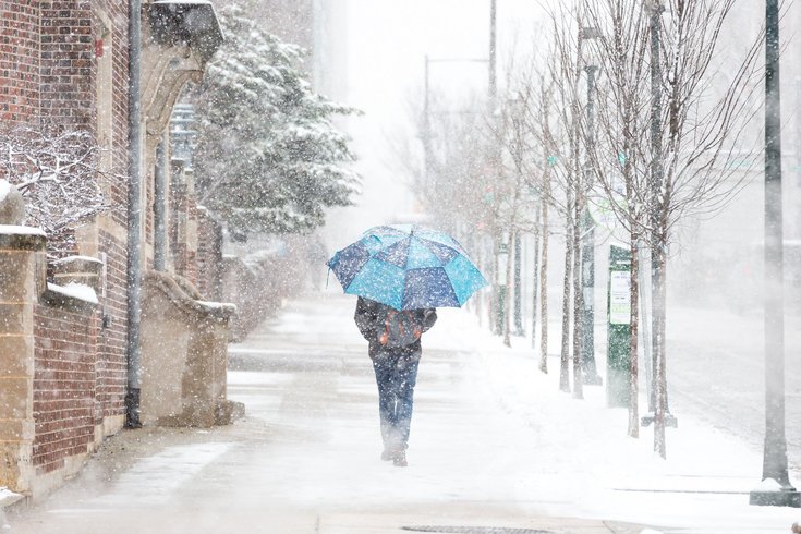
The city on Friday declared a snow emergency starting at 9 p.m. Saturday.
With a winter storm threatening nearly half of the United States, state and local governments are scrambling to come up with contingency plans and relay them to their constituents.
In Philadelphia, Mayor Cherelle Parker on Friday declared a snow emergency, which will go into effect at 9 p.m. Saturday and remain in place until "roadway conditions improve."
MORE: What groceries do people panic buy before a snowstorm? It's more than just milk, eggs and bread.
During that time, vehicles will not be able to be parked on the 110 miles of Philadelphia's snow emergency routes. Cars found on those roads will be ticketed or towed. City lots will be available for a flat $5 rate starting at 7 p.m. Saturday.
The National Weather Service is predicting the Philadelphia area will see 12-18 inches of snow between Saturday night and Monday morning. Meteorologists also say there could be a mix of sleet and freezing rain, which would impact accumulation totals. Following the storm, temperatures are expected to remain below freezing every day next week, so it will be a while before weather conditions allow the piles of snow to melt.
The Philadelphia Streets Department began salting roads on Wednesday and plans to use 1,000 workers, 600 pieces of equipment and 30,000 tons of salt over the duration of the storm. Despite those efforts, residents have been asked to stay off the roads starting Saturday night.
"Please take this storm seriously," Parker said. "Now is the time to prepare before precipitation begins to fall on Saturday. Limit unnecessary travel once conditions worsen, and if you must be out, give yourself extra time, drive slowly and stay off the roads if conditions become hazardous so our crews and first responders can do their jobs safely."
Parker's administration said an official decision on whether city offices will be open Monday will be made by 8 a.m. Sunday.
School District of Philadelphia schools will be closed Monday, Superintendent Tony Watlington said. And Archdiocese of Philadelphia Schools, which are located in the city and the surrounding suburban Pennsylvania counties, also will ber Monday.
Pennsylvania Gov. Josh Shapiro on Friday evening signed a Proclamation of Disaster Emergency, which provides agencies with resources and allows the state to quickly use funding to assist municipalities in response efforts.
The most recent budget increased the state funding available in these orders from $20 million to $40 million.
“This declaration gives (the Pennsylvania Emergency Management Agency) the flexibility to pre-position resources, streamline coordination, and respond quickly if conditions deteriorate this weekend,” PEMA Director Randy Padfield said in a statement.
New Jersey Gov. Mikie Sherrill issued a state of emergency Friday afternoon, her fourth day in office.
"This is a storm the likes of which we haven't seen in probably about a decade," she said during a news conference.
The order goes into effect for all 21 counties at 5 p.m. Saturday in anticipation for heavy snow, below freezing temperatures and wind gusts up to 30 mph.
The New Jersey Department of Transportation also issued a commercial vehicle restriction on most major highways for tractor trailers, passenger vehicles pulling trailers, RVs and motorcycles at 12:01 a.m. Sunday.
"Make a plan to stay home," Sherrill said in a social media post. "Make a plan to catch up on your reading, watch the football, play some board games with your kids, but this is a good weekend to stay in and off the roads."
SEPTA is telling customers to expect slower service and possible suspensions of some lines as storm conditions worsen on Sunday.
General Manager Scott Sauer said riders should expect impacts to buses, trolleys and Regional Rail. That will "almost certainly" include trip cancellations and the possibility of a total service shutdown, he said. SEPTA recommends using the Broad Street and Market-Frankford lines to get around the city, since they're primarily underground, and plans to operate overnight service on them where possible.
Service updates will be provided on SEPTA's website and the SEPTA app. When possible, SEPTA aims to give customers two hours' notice before any service shutdowns.
To make sure city vehicles can focus on snow removal, trash and recycling will be suspended on Monday and all pickups for the remainder of the week will be pushed back by a day. There will be no twice-weekly trash pickup next week. All driveway collections are also suspended, and residents who receive that service have been asked to bring their trash to the front of their homes or take it to the city's sanitation centers instead.
PennDOT said Friday that non-passenger vehicles, motorcycles and RVs are not prohibited Pennsylvania interstates, including the Pennsylvania Turnpike, from midnight Saturday until road conditions improve.
On Tuesday, the Office of Homeless Services declared an enhanced code blue, which is in place until further notice. While that is activated, a number of libraries will serve as warming centers from 9 a.m. to 9 p.m. and five recreation centers will be overnight warming centers from 9 p.m. to 9 a.m. Water, blankets, snacks and meals will be provided. City outreach teams are also being sent out to locate people experiencing homelessness and connect them to resources.
Crystal Yates-Gale, deputy managing director for health and human services, said the city's shelters were at capacity on Thursday night. All of the warming centers except the one in the Northeast were also at capacity, she said, but the city plans to add 150 beds over the next couple weeks.
City officials have a "lifting and melting operation" in place to remove snow, especially in densely populated neighborhoods with narrow streets. Plows and other vehicles will "lift" the snow from streets and sidewalks and take it to an industrial-sized melter or designated locations such as grocery store lots.
Residents must clear 36-inch paths on sidewalks in front of their homes, and the city can issue tickets to properties with uncleared walkways six hours after the storm ends. City officials also asked that people not pile up snow mounds with snowblowers, as it can disrupt operations.
Philadelphia International Airport recommends travelers to check the status of their flights heading into the weekend.
"We are seeing a handful of cancellations and delays throughout the weekend right now and anticipate that will increase as we get closer to the start of the storm," airport spokesperson Heather Redfern said.
The airport recommends travelers follow Flightaware to keep track of delays and cancellations.
The National Weather Service early Friday afternoon issued a winter storm warning that blankets all of Philadelphia, the suburbs in Southeastern Pennsylvania and South Jersey.
In the city, Delaware County, Chester County and eastern Montgomery County, plus Camden, Gloucester, Burlington and Cumberland counties in New Jersey, expect heavy snow and mixed precipitation. Snow totals will be between 8 and 10 inches, potentially topped off with more than a quarter inch of ice.
At the Jersey Shore, in Cape May and Atlantic counties, 6 to 10 inches of snow are predicted with ice accumulations about 1/10 of an inch and winds gusting up to 35 mph. The NWS says Bucks County and western Montgomery County have the potential to get the most snow – 10 to 15 inches combined with about 1/10 of an inch of ice.
Ice will accumulate on power lines and trees throughout the region, the NWS says, creating the downed limbs and lines and potentially long-lasting power outages.The NWS advises against traveling during the storm, but those who must go out should be prepared with food, water, blankets, a flashlight and other emergency supplies in their vehicles.
All the winter storm warnings take effect from 7 p.m. Saturday.
Here is the NWS daily weather forecast for Center City through Tuesday. For the forecast closer to you, visit the NWS website.
FRIDAY NIGHT: Low around 9 degrees and wind chills that feel like -6. Gusts as strong as 30 mph.
SATURDAY: Daytime high temperature around 20 degrees. Snow begins, accumulation 1-2 inches
SUNDAY: Snow, heavy at times throughout the day, will become a mix of snow, sleet and ice in afternoon and into Sunday night. High near 27; low around 21. Wind gusts reaching 30 mph. Snow accumulation 7 to 12 inches plus about a quarter inch of ice.
MONDAY: Morning snow likely, ending by 7 a.m. Partly sunny, high temperature of 29; overnight low of 7 degrees.
TUESDAY: Mostly sunny but cold. Daytime high of 19; overnight low around 6 degrees.