August 02, 2016
 Source/City of Philadelphia
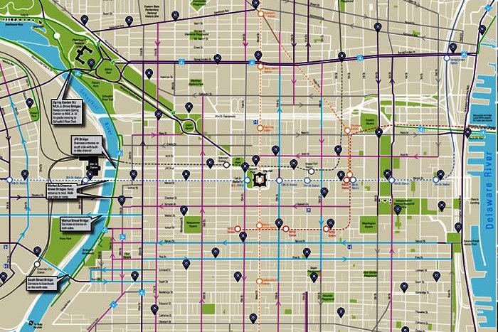
The new biking map from the Philadelphia Planning Commission.
The Philadelphia Planning Commission has released a new map (pdf) showing bicycle lanes, shared lanes and Indego bikeshare stations throughout the city.
The first updated map since 2014, its most visible changes reflect the launch of Indego’s bikeshare program and a recent $300,000 grant from the Delaware Valley Regional Planning Commission to build more city bike paths.
“It’s about time Philly saw some more protected bike lanes," Randy LoBasso, spokesman for the Bicycle Coalition of Greater Philadelphia, told PlanPhilly after the March announcement of the DVRPC grant. “Philly is behind many cities in the country as it pertains to physically-protected bike lanes, and we hope the $300,000 for facilities can supplement the plans the city and state already have in place for protected, safer infrastructure.”
The new map also details possible connection paths for the future — such as one from Logan Square to the Delaware River down Race Street.
“Philadelphia's walkability and bikeability are incredible assets that contribute to a high quality of life, and make our city a highly desirable place to live and work,” Mayor Jim Kenney said in a statement about the map update. “That’s why we are improving and expanding the infrastructure to support these activities in every neighborhood of our city … We are adding more Indego bikeshare stations and boosting the number of miles of safe bike lanes, so more people can comfortably choose biking as a way to explore.”
The old map can be found here (pdf).