


August 17, 2023
During the dead period of the NFL calendar, I was seeking a summer hobby and decided that biking along as many New Jersey shore towns as I could get to would be a fun way to (a) get some exercise, (b) see some stuff, (c) try some new restaurants, and (d) provide me with some content. If you'd prefer I stick to the Eagles, well, sorry. 🤷♂️
Please note that as I add to this post throughout the summer, I'll have the most recent shore town reviews at the top.
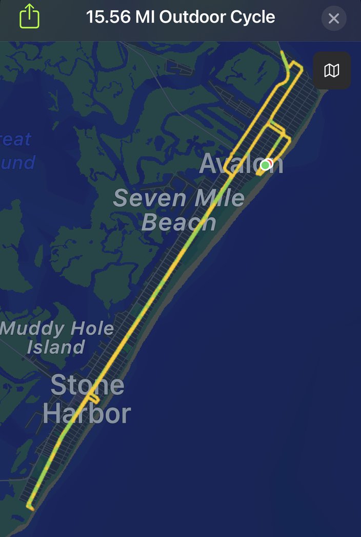
• Time: 1:23:20
• Distance: 15.56 miles
• Total calories: 720
• Active calories: 542
• Average speed: 11.2 MPH
Avalon and Stone Harbor are New Jersey shore towns I haven't often visited, and I was surprised by how little is there, in terms of restaurants, bars, shops, amusements, etc. It's mostly just a whole lot of houses, and a beach. It's not quite on the same level as Brigantine (reviewed below) on the "not much there" front, but it certainly does not have anywhere close to the number of establishments per square mile as, sayyyy, LBI, Ocean City, Wildwood, etc. I'm not knocking it for that, to be clear. It just is what it is.
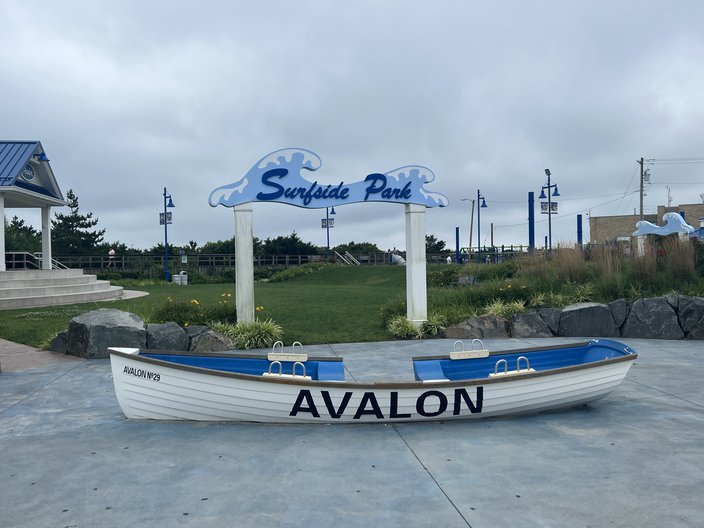
Obligatory decorative rowboat:
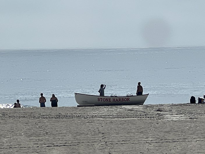
And an actual in-use rowboat:
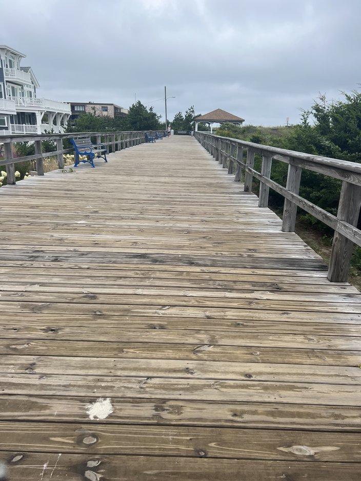
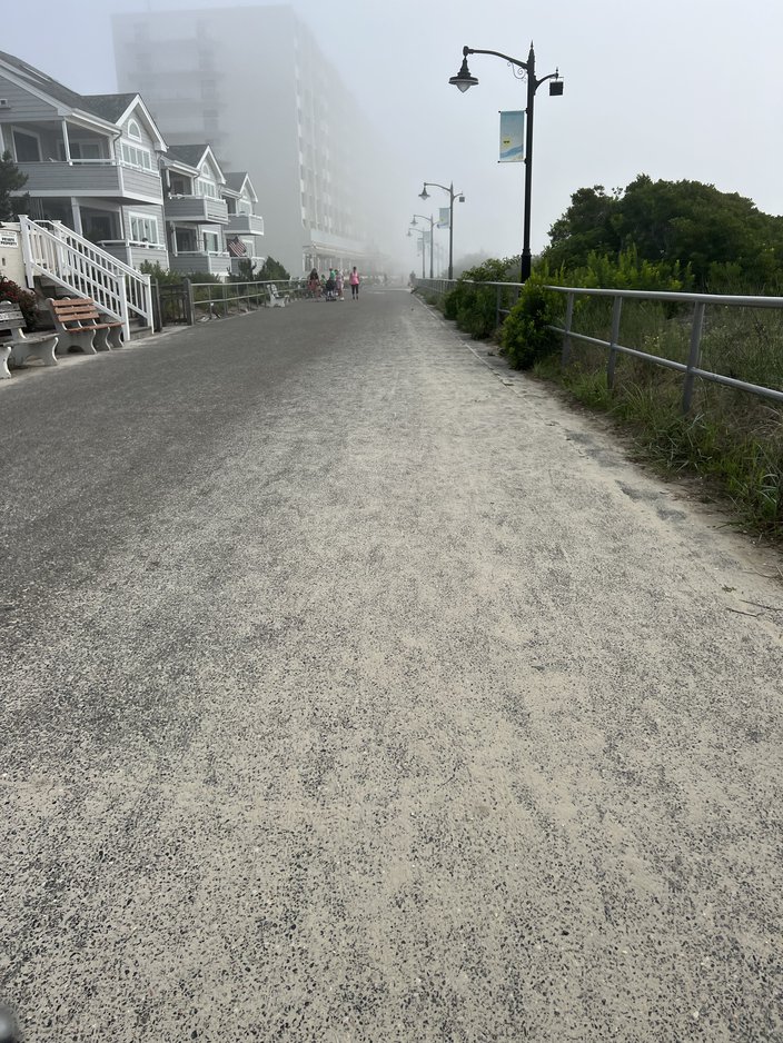
I started the ride on the Avalon boardwalk, which is super short (only about a half mile long), and there isn't much in the way of shops. Like the rest of the island, it's lined by houses and the beach. It's also narrower than the other boardwalks along the Jersey shore.
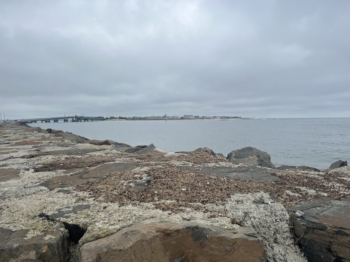
I got there early enough to ride on the boardwalk, but bikes are banned after 10 a.m. After the (estimated) 30 seconds it took me to finish the ride on the boardwalk (lol), I headed north toward the bridge to Sea Isle. Snapped a pic of that here:
I then biked the roughly seven miles south toward the bridge to Wildwood.
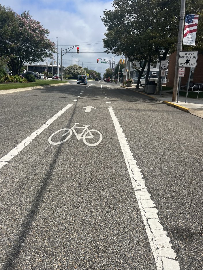
Avalon and Stone Harbor have a good bike lane all along Dune Drive, and the speed limit for cars is 25 MPH. That's awful if you're in a car, but it's nice and safe if you're on a bike. There's a traffic light in the following pic showing the bike lane, but there are barely any lights on the island.
Grade
I wish I had more to say, but... 🤷♂️. Avalon and Stone Harbor are quiet, chill beach towns, and they are bike-friendly. If "quiet and chill" floats your boat, have at it. I'd probably prefer more restaurants and bars and such if I lived there, but for a short bike ride it was fun. 8/10 bikies.
🚲 🚲 🚲 🚲 🚲 🚲🚲 🚲
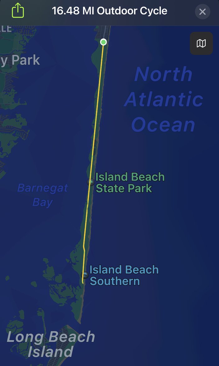
• Time: 1:14:48
• Distance: 16.48 miles
• Total calories: 812
• Active calories: 652
• Average speed: 13.2 MPH
Island Beach State Park is perhaps best known for the time it was shut down in July of 2017 because former New Jersey governor Chris Christie wasn't getting his way on some budgetary differences. Christie was subsequently busted lounging on an entirely empty beach like it was his own private island, lol.
New Jersey governor Chris Christie shut down Island Beach State Park so his family could use it. @AndyMills_NJ got some great aerial shots pic.twitter.com/SemiurQ1KE
— David Sim (@davidsim) July 3, 2017
Photojournalist Andy Mills gambled that Christie would be taking advantage of the government shutdown for his own personal gain, so he had a plane fly by as he snapped pictures of Christie, which, I mean, as a fellow journalist myself... Bravo 👏. That is simply A++ work.
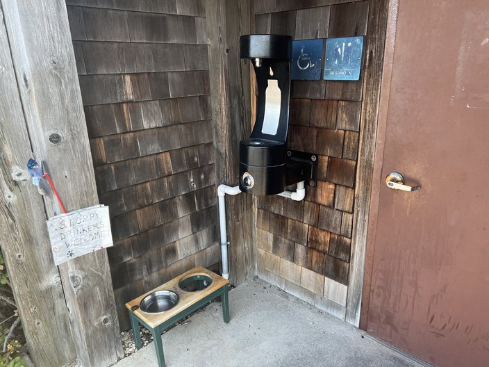
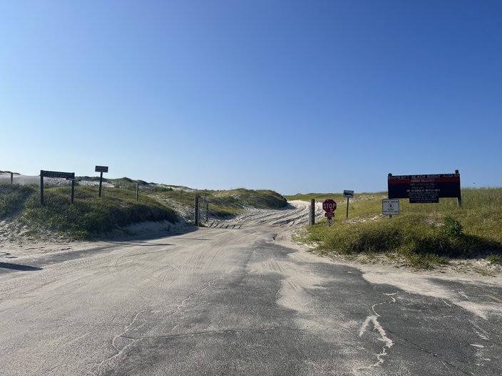
Anyway, there was no government shutdown of Island Beach State Park for my bike ride. I failed to take a pic of the entrance to the park, because I'm a dumbass and not as good a photojournalist as Mills. I did get a pic of a water station outside of a bathroom at the entrance. Bonus points for thinking of the pups.
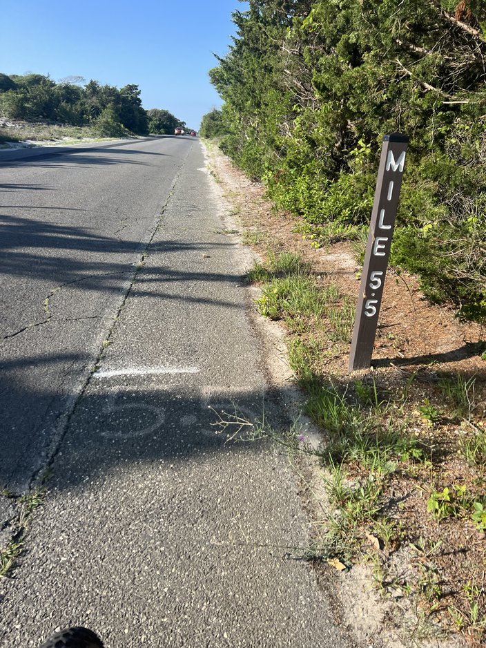
There isn't much to see on the ride from the entrance to the park to the end of the road. It's basically just an 8.25-mile road with brush on each side, occasional parking, a very small shoulder, and mile markers at each half-mile.
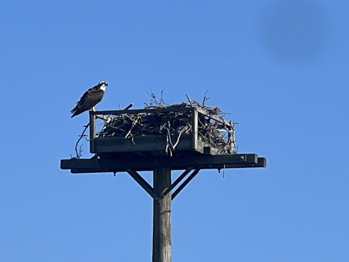
There was also an osprey nest along the way. My daughter named this guy/gal Gerald.
You can watch the osprey nest live here. Last I looked, it was Gerald and a couple young birds learning how to fly.
There are apparently a lot of foxes (as in the animal, not necessary pretty women) on Island State Beach Park, and stern warnings not to feed them. I hoped to see one, but I did not. There are also seals (!) when the water temps are lower from the end of the fall to early spring. I love a seal.
Here's what the end of the road looks like. Vehicles that can handle the sand can drive onto the beach down there like it's North Carolina.
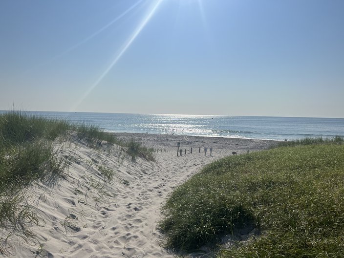
If you walk up to the beach via the foot path, you're greeted by a clean beach...
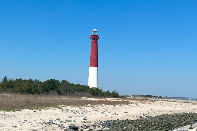
...and a view in the distance of the Barnegat Lighthouse on LBI.
The ride to the south end of the park was a breeze, with the wind at my back. The ride back, with the wind in my face... not so much. So, you know, be mindful of that.
Grade
I think the appeal of Island State Beach Park is that you can drive there and get away from the crowded Seaside beaches. If you like a straight ride without a lot to look at, then this ride is for you. Personally, I prefer a little more visual variety, and a wider shoulder. 5/10 bikies.
🚲🚲 🚲 🚲🚲
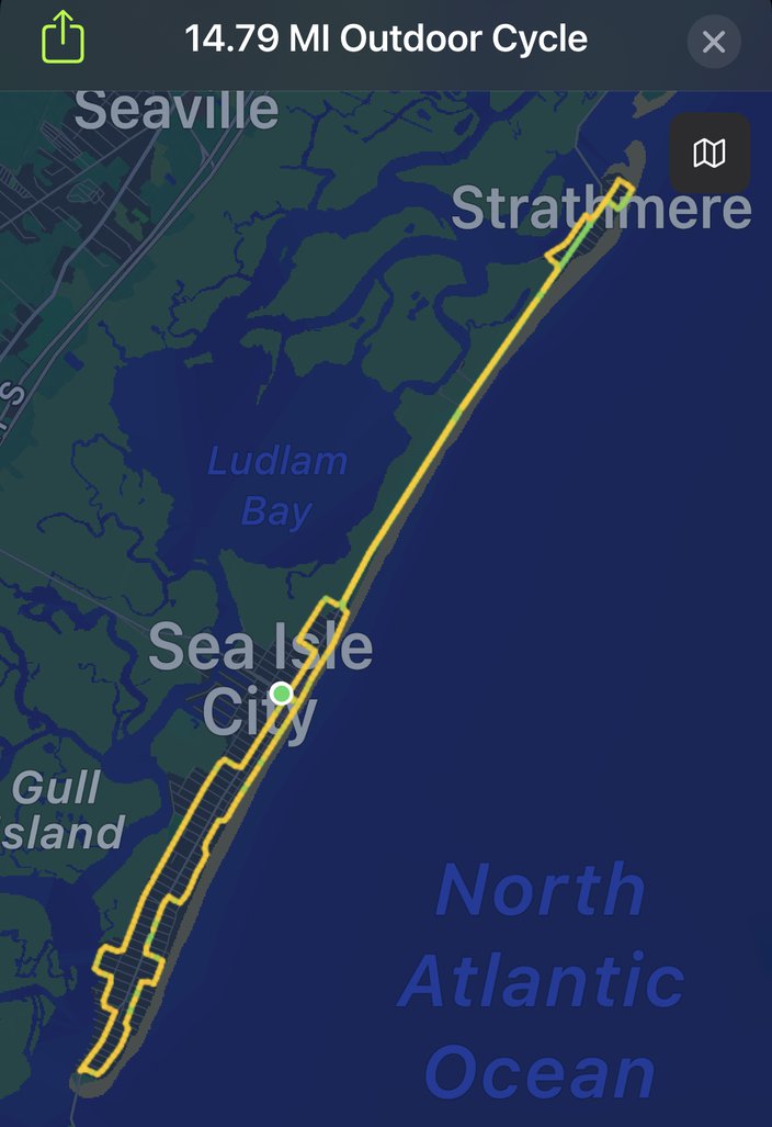
Route and stats:
• Time: 1:12:52
• Distance: 14.79 miles
• Total calories: 705
• Active calories: 548
• Average speed: 12.1 MPH
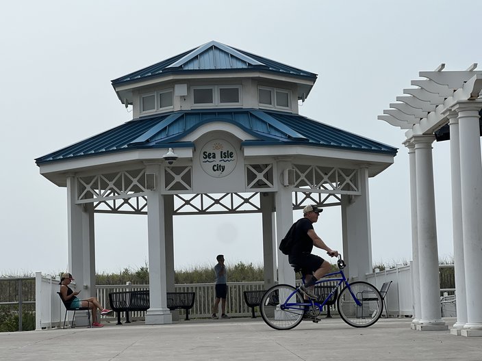
Let's get all the generic Sea Isle pictures out of the way right off the bat. There's the Promenade, which is what they call their boardwalk. It's not wood. It's asphalt, unlike Ocean City or Atlantic City, but we'll get to that shortly. This gazebo-looking thing is featured prominently on the Promenade.
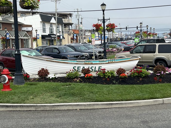
Obligatory decorated row boat:
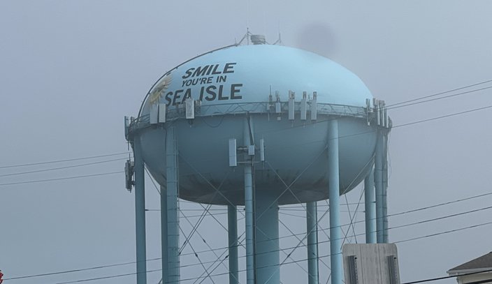
And they have a quirky water tower.
That rhymes.
Sea Isle is perhaps best known for it's nightlife, and the cluster of outdoor bars situated in the middle of the island, like Ocean Drive, O'Donnell's Pour House, and Shenanigans, to name a few.
Speaking of Ocean Drive, that is of course the favorite shore bar of Eagles center Jason Kelce. Here were the Eagles jerseys I saw during my ride:
• Jason Kelce: 3
• Everybody else: 0
If I can offer some unsolicited advice for local athletes... Find a shore town you like, talk about it occasionally, maybe wear some merch, and you'll be legend in that shore town for life. It's really an untapped market for player popularity.
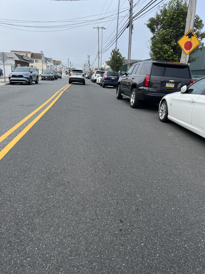
Anyway, I started my ride near the bar district, and headed south. I tried each of the three main roads on Sea Isle — Landis Ave., Central Ave., and Pleasure Ave. I suppose Pleasure Ave. was the safest, but they were all bad. No bike lane, no shoulder. It just sucks, and it's dangerous. You're basically out in the middle of the street and if there's a car behind you there's no way of them getting around you until oncoming traffic subsides. You can almost feel the hatred of the drivers having to drive 10 MPH behind you until they can pass, and I don't blame them.
Because you have to ride tightly up against parked cars on the side of road, you're in constant fear of some jackass opening their car door without looking, like in "This Is 40."
That definitely happens all the time in Sea Isle, right? I mean, it has to.
Apparently the folks who run Sea Isle are well aware that the town sucks for cycling and even walking, because there were once plans to extend the Promenade the entire length of Sea Isle. That was in 2015, which we covered here at PhillyVoice.
City council approved a resolution that would extend the shore town's Promenade across the length of the entire island to take on cycling and pedestrian traffic. The $1 million extension comes as a part of the city's “Adopting the 2016-2020 Capital Plan,” and officials are hoping most of the funding will come from grant money.
According to the Press of Atlantic City, the plan comes in response to complaints made about an abundance of runners and cyclists on Pleasure Avenue, the roadway that runs north to south along a large chunk of the island. Safety precautions such as flashing red lights and a lowered speed limit have been implemented to help address the issue, however the road cannot be widened to cater to everyone wishing to use the road.
Under the new plan, the Promenade, which currently runs parallel with the beach between 29th and 57th streets, would be stretched north to 1st Street and south to 93rd Street; simply put, it would cover the entire length of Sea Isle. Construction could be complete by 2019 if a design is finalized by 2017 and grant money is obtained by 2016, the Press reports.
Yeah, it's now 2023, so according to my math that shit wasn't completed by 2019. According to TheShoreBlog.com, "a movement to expand the Promenade to the entire length of the island to reduce pedestrian and cyclist traffic on the streets was defeated in 2016 by the concern of residents and the environmental impact it would have on the dunes."
I'm sure it was just the "environmental impact," and nothing else. 👍
The ride on the Promenade is enjoyable enough, but it's only about 1.5 miles long. It's really just a tease. And as you can see, it doesn't look like a typical boardwalk.
When the Promenade ends at the north end, you'll soon be in Strathmere, a town I didn't even know existed until like 10 years ago. People from Strathmere freaking love Strathmere. I get it. It's a quiet area, with easy bridge access to Ocean City to the north, and nightlife to the south. It's perfect for 30- and 40-somethings with families who like to do stuff with their kids but who also get after it on occasion.
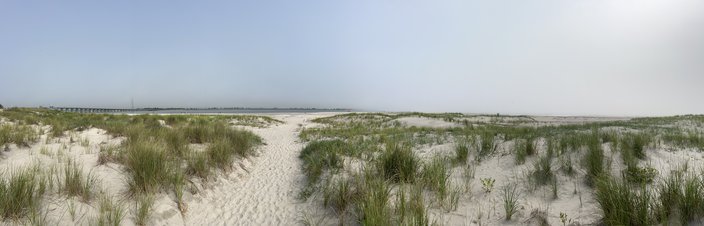
The biking there is far, faaaar better than in Sea Isle. Here's a pano shot of the end of the island.
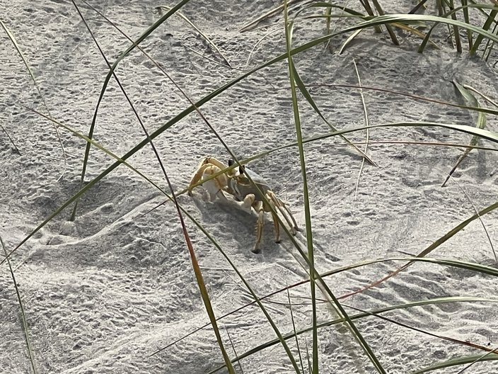
While there, I met this little critter.
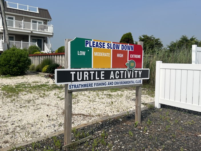
I texted my daughter to name him/her, and she went with Booberry. I have to say, that's a great name. Booberry ran out in front of me and scared the bejesus out of me. On the wildlife front, a lot of Jersey shore towns have signs that say to watch for turtles. This is easily the best one to date, in Strathmere.
I wonder if some official turtle expert actually moves that turtle to the left and right of that sign based on the day's turtle activity. I'm guessing no? We should all just always be alert when driving, IMO.
Actually, one thing I'll note here is that I saw quite a few dead turtles in Ocean City. It didn't appear as though they were hit by cars on the road. Rather, it looked more like folks backing out of their driveway were running over turtles because they couldn't see them. So if you live in a shore town rife with cute turtles and don't want to kill any, I would recommend taking a hot second to check behind your car for turtles before you throw it in reverse.
Grade
Strathmere made up for some of Sea Isle's deficiencies, but I can't in good conscience give this ride any more than four bikies when they know their town sucks for biking and they're not doing anything about it. 4/10 bikies.
🚲🚲 🚲 🚲
Route and stats:
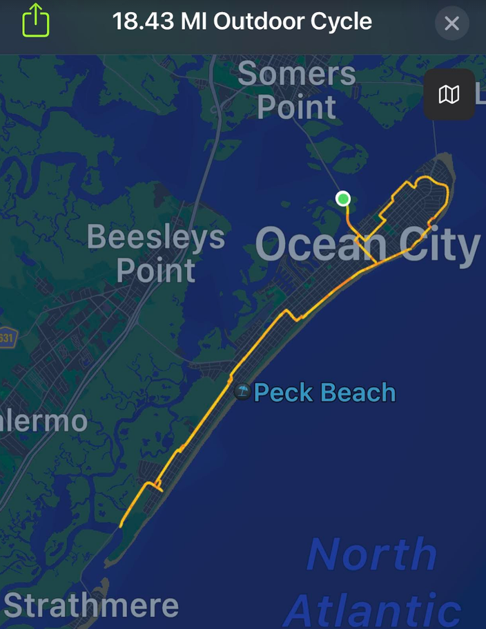
• Time: 1:50:29
• Distance: 18.43 miles (out and back)
• Total calories: 865
• Active calories: 629
• Average speed: 10.0 MPH
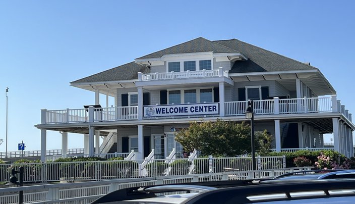
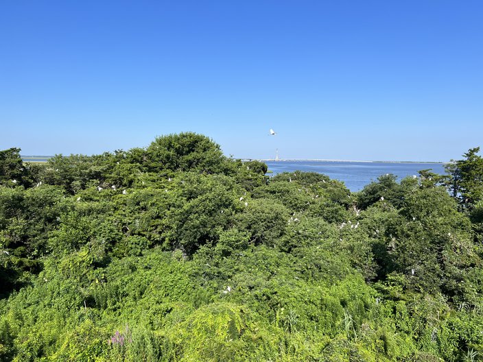
On the way over the bridges to Ocean City, there is a "Welcome Center."
If I lived in Ocean City, that feels like the kind of place I'd drive by thousands of times but never visit. But, well, I visited it, to excrete pee before the ride. While there, to my surprise, there were about a dozen people taking pictures over the railing. I went to go check it out, and oh hey... birds!
Because there is a super wide bike-only section of the bridge, I just rode the rest of the way into Ocean City. Warning: It's easy to ride over the bridge from the Welcome Center on the way there, not so easy on the way back.
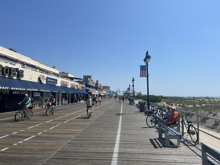
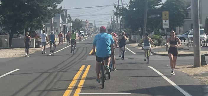
The main attraction in Ocean City is the boardwalk. I've only been to Ocean City about a half dozen or so times in my life, and I guess I forgot how awesome that boardwalk is. It's basically just a long-ass row of arcades, amusement parks / waterparks, pizza joints, homemade donuts, ice cream, mini-golf, candy stores, I think I saw go-karts, etc. I feel like 12-year-old me would be a nightmare to take to this boardwalk because I'd be beyond overstimulated. I'm definitely going back with my daughter (who is much more well-behaved than I was when I was a kid) at some point this summer.
If you're on a bike, there are a lot of people, and you're not going to break any personal speed records.
Once the boardwalk ends on the south side, you're back on the road the rest of the way, and Ocean City does a fantastic job of carving out areas specifically for biking, mostly on (or next to) Haven Ave, like this:
I rode all the way down to the base of the causeway (that goes to Strathmere / Sea Isle City) and stopped at Corson's Inlet State Park. This wouldn't be the type of beach I'd be interested in, but to each their own.
On the way back, I stopped at Mallon's Bakery for some sticky buns for my mom. Those things are heavy. I had my detachable basket fixed on the front of my bike for this whole ride just for these sticky buns, and probably looked like a nerd. Does that make me Son of the Year? Probably.
After the ride was over, I stopped at Crabby Jack's in Somers Point for a couple of beers. Cool place on the bay. I should also probably note here that Somers Point is the unsung hero when it comes to Ocean City, which is dry. Stopping at a liquor store before heading over the bridge is a must for those who imbibe.
Grade
The biking experiences here are varied. You can take it easy on the boardwalk, you can ramp it up a bit along Haven Ave, or if you're into hills and a more challenging ride (harder to find at the shore, which of course is flat), the bridges can provide that. There's a lot to see, and the folks in charge here have clearly made efforts to make it a bike-friendly town. 9/10 bikies.
🚲 🚲 🚲 🚲 🚲 🚲🚲 🚲 🚲
As always, the route and the stats first:
• Time: 1:27:15
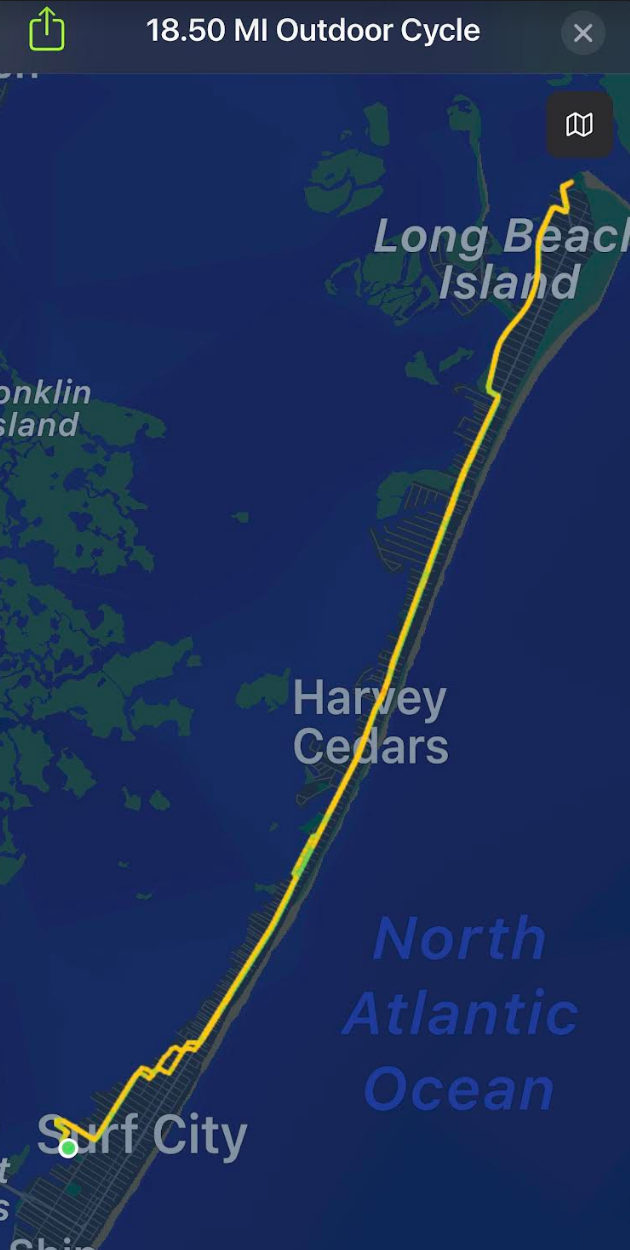
• Distance: 18.50 miles (out and back)
• Total calories: 888
• Active calories: 700
• Average speed: 12.7 MPH
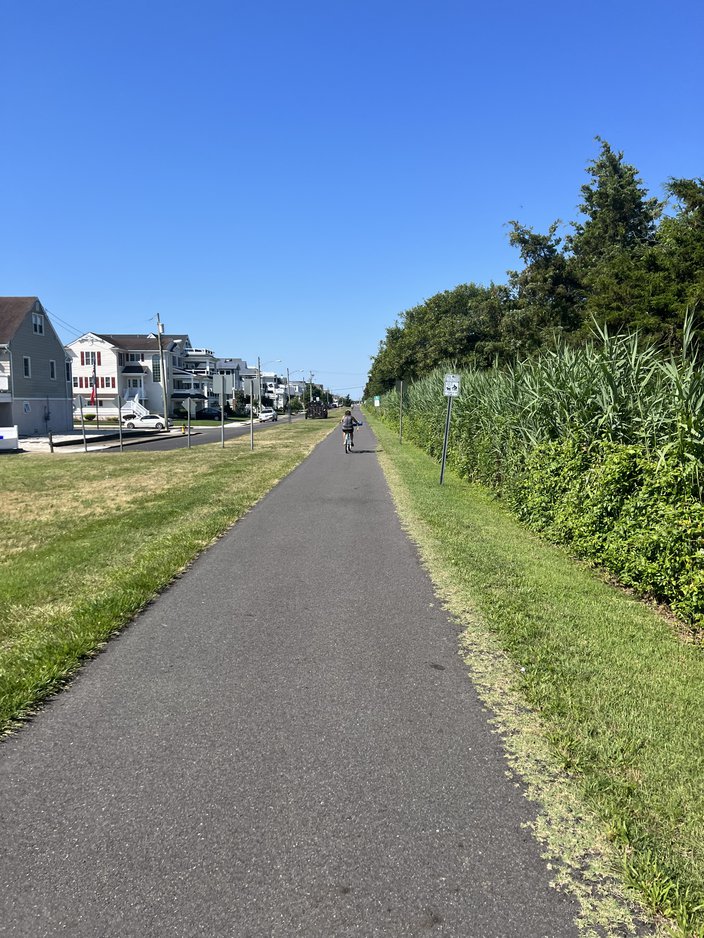
If you're unfamiliar with LBI, there's one bridge onto the island (I complain about that in more depth in the other LBI entry below). Once on the island you can either turn right, which is the south end (Ship Bottom, Brant Beach, Beach Haven, etc.), or you can turn left, which is the north end (Surf City, Harvey Cedars, Barnegat Light, etc.).
The south end is packed during the summer, and is loaded with all sorts of restaurants, bars, and things for kids to do. On the north end, there's Surf City, which is a lot like the towns on the south end, but once you reach the end of Surf City, it's basically just a lot of ginormous houses until you get to Barnegat Light, with a small area in Harvey Cedars in between, where there are a few places to eat.
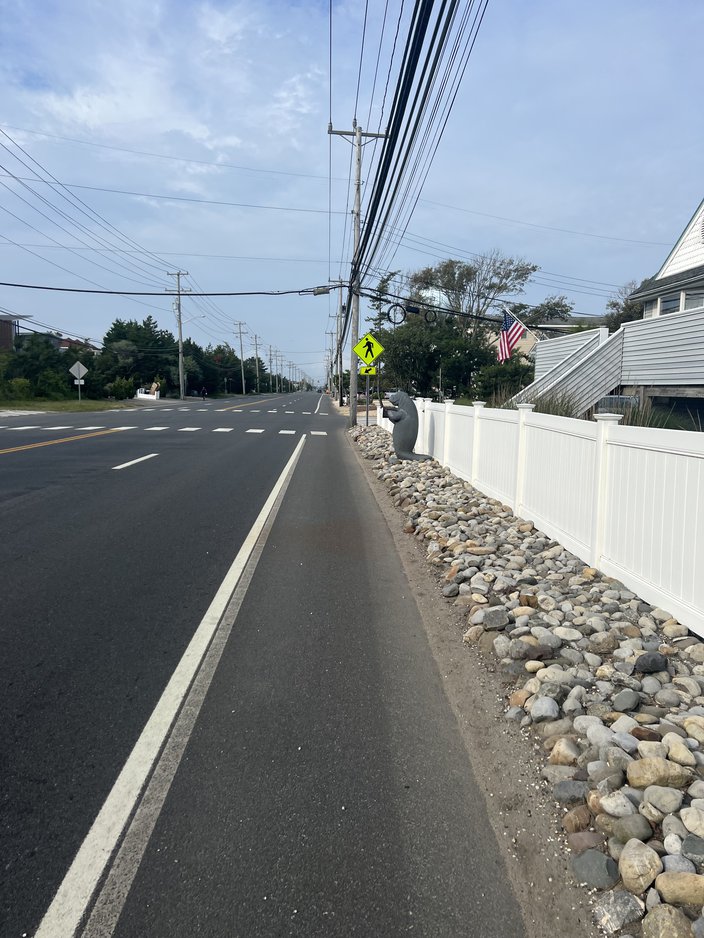
Like the south end review of LBI further below, this is a ride I have done quite a bit. I don't like this route when it's busy because there are parts through North Beach, Harvey Cedars, and Loveladies where there is a very small shoulder (it's more like a half-shoulder), and no other side streets to avoid the traffic. For example:
I should note the manatee mailbox in the above pic is normally dressed up in various outfits. If anyone knows who lives there, please let them know that I appreciate their efforts to keep the manatee looking stylish, and that I was disappointed that it was naked for my ride.
Getting back on track, the small shoulder is problematic because every time you're either passing another cyclist on the road — or if there's someone walking/jogging toward you — you have to take a peek behind you to see if there is a car coming before you pass them. I began my ride at 6:36 a.m. before there was heavy foot/bike traffic, and I was still looking over my shoulder every minute or two. It's annoying. 🤷♂️
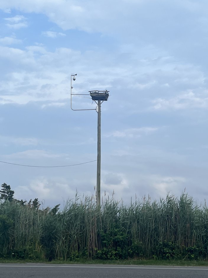
The highlight of this ride for me is always in Barnegat Light. Heading toward the lighthouse at the end of the island, I usually turn left onto 30th Street, where there's a side street. Along that road, there's a bird sanctuary (ospreys), and on a rare occasion you'll come across a turtle. Here's the osprey nest (with a camera where you can watch them online):
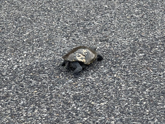
And as luck would have it, there was a turtle crawling along slowly on the road. Boom. I should have gotten a better pic, but whatever. My daughter would later name it Susan, so we'll refer to this turtle with female pronouns from here on out, though I have no idea whether it was male or female.
I picked up Susan and brought her back to the sand. Along the way, she tried to get my hands off of her by pushing them with all four of her legs. I'm trying to help you, Susan, you dope. Guess what happens if I drop you because you successfully dislodged yourself from my grip.
Some would call me a hero for saving Susan's life. Those folks are probably right, and thanks for noticing.
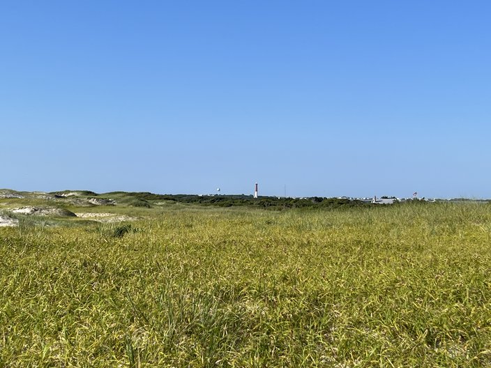
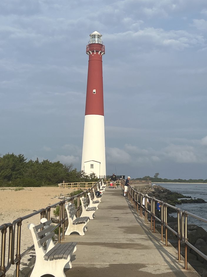
At the end of the island, there's "Old Barney" the lighthouse, which you have probably seen on NJ license plates if you've never seen it in person.
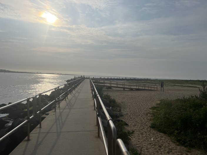
I always like to walk down to the end of the path near the lighthouse whenever I ride down that way (no bikes allowed in this area):
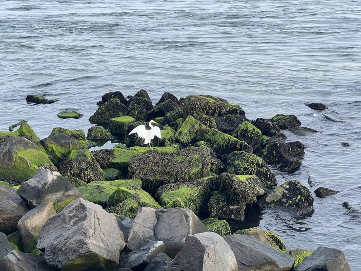
There's a lot of wildlife near the lighthouse, like snails and egrets. I like an egret.
Grade
This is the non-crowded end of LBI and for more than half of it there's inadequate room to ride, in my opinion, at least for a shore town. This ride would grade out worse if not for the wildlife. 6/10 bikies.
🚲 🚲 🚲 🚲 🚲 🚲
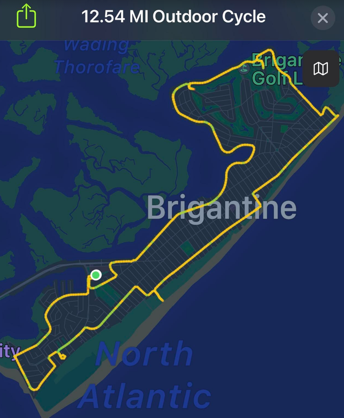
First the route and the stats:
• Time: 1:01:03
• Distance: 12.54 miles (loop)
• Total calories: 603
• Active calories: 471
• Average speed: 12.2 MPH
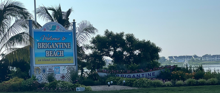
This will probably be the shortest bike ride of the series, as Brigantine is a small island that is only accessible via a bridge from Atlantic City. Upon entering Brigantine, you'll see the obligatory row boat turned giant flower pot with the name of the town painted on the side.
One of my first thoughts when I started riding was something to effect of, "Hey, this is quiet and nice, I kinda like it here," which reminded me that I'm getting old. It is an extremely residential town (AKA house after house after house) with nowhere near the number of restaurants and attractions of most other Jersey shore towns.
For the duration of my 12.54 mile ride, I don't recall seeing one human being under the age of 25. Like, not even a baby in a stroller. I should note that my ride began at 7:20 a.m., and when I was kid I was rarely up that early. But still, I don't think it's a stretch to say that it's an older crowd. That's not a criticism, to be clear. Just an observation. 💓👴👵💓
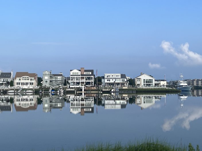
A nice chunk of my route was along the water, and there was no wind, which made for scenes like this:
Or this:
Or this:
So, you know, it's a peaceful-looking town. There were also barely any cars on the road at all, even by the lighthouse, which is probably the "busy" part of the island, I guess.
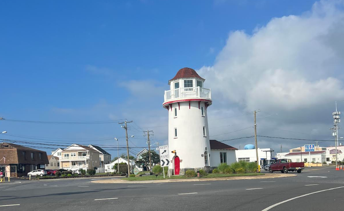
If you're wondering why that lighthouse is in the middle of the town as opposed to on the water, it's because it's not a real functioning lighthouse. They just built that thing in the 1920's because they thought it would attract tourists. It also does not tilt to the left — I snapped that pick without stopping.
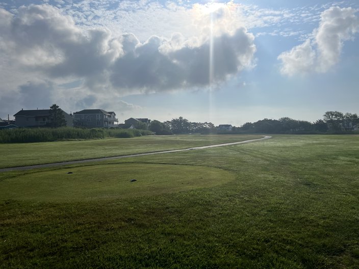
There's also a golf course on the island, which is rarity on the Jersey shore. I haven't golfed there in a while, but in my 20's that was probably my favorite course.
Bring bug spray if you check that out.
I did not stop for a meal because I was headed to LBI after my ride, and I was afraid of getting stuck in Friday traffic if I lingered a little too long. (You can hear me complain more about LBI's traffic problems in the section below.)
Grade
Honestly, there's not a lot to say here. Brigantine is not a place I would go to if I were looking for nightlife or things to do with my kid, but it made for an uncrowded, visually satisfying bike ride. 8/10 bikies.
🚲 🚲 🚲 🚲 🚲 🚲 🚲 🚲
First the route and the stats:
• Time: 1:48:50
• Distance: 21.98 miles (total, up and back)
• Total calories: 1061
• Active calories: 828
• Average speed: 12.1 MPH
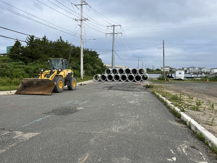
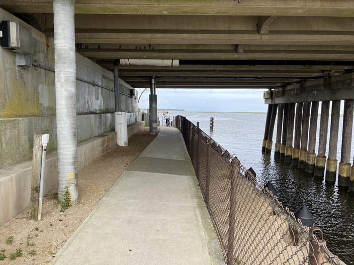
I started in Surf City, near the only bridge on and off of the island (only two lanes each way). The area near the bridge is an absolute cluster-F during the summer, but especially on the Fourth of July. So, pro tip: Go under the bridge. On the south side of the bridge, there's a small playground by the bay, and you can go under the bridge from there. On the north side, there is some construction equipment that sits in the way of you and the area under the bridge.
Ignore that stuff, go right around it, and under the bridge.
Let's stay with the topic of the bridge for a moment. During the summer when the island is packed there can be upwards of 250,000 people here. The land mass is, by my count, 9.27 square miles, broken up like so:
| Town | Square miles |
| Long Beach Township | 5.45 |
| Beach Haven | 0.98 |
| Barnegat Light | 0.83 |
| Surf City | 0.74 |
| Ship Bottom | 0.71 |
| Harvey Cedars | 0.56 |
| TOTAL | 9.27 |
When the island is packed, if we were to use a figure of 250,000 people, the population density is 26,969 people per square mile. Here's how that compares with other major cities (using data from a 2010 census posted on Wikipedia):
| City | People per square mile |
| New York City | 29,095 |
| Long Beach Island (when packed) | 26,969 |
| San Francisco | 17,246 |
| Boston | 13,321 |
| Chicago | 11,868 |
| Philadelphia | 11,233 |
In summary, uh, yeah, there's a lot of people here. Traffic on and off the island on Saturdays during the summer is an absolute nightmare, and it's not that uncommon that if you're staying on the far south end of the island and you try to leave at the wrong time you'll be sitting in traffic for over three hours just to get off the island.
I kinda can't even imagine the bedlam that would ensue if the island had to be evacuated for some reason during the busy season, or if something happened to the bridge. I'm no expert on infrastructure, but maybe a second bridge on the popular south end of the island would make some sense? 💡
As long as I'm ranting — and because I mentioned the six LBI towns above — if you live in Surf City and you want to go to the beach in neighboring Ship Bottom because you have friends there, you're buying a separate beach badge. Can we just cut the shit and make beach badges acceptable for all towns on the island?
I believe the same applies for most shore towns up and down the Jersey coast that share the same island. To be clear, I'm certainly not saying that a beach badge for a shore town in LBI should grant you permission to a beach, in, say, Wildwood. But if you have a badge for Margate, for example, you should be able to use that in neighboring Ventnor. These towns have to know full well how inconvenient and annoying it is for beachgoers to have to buy a badge to allow them access to the beach on one street, and a separate badge on the next street over if it's in another town.
OK, back to the bike ride.
When you drive over the bridge onto Long Beach Island, you're in Ship Bottom, which isn't a super hospitable biking town. The side streets are fine, I guess, but there's a short stretch where the only road that runs north-south is Long Beach Boulevard, the main road on the island. You have to cross it to get to Ocean Boulevard, which begins at 31st St. on the border of Ship Bottom and Brant Beach. That can be a little dicey during the high season if you're with kids.
Once you get on Ocean Blvd., It's basically a long stretch of super-expensive houses on one side, and somewhat less super-expensive houses on the other. The shoulder simply doesn't fit the cyclists, runners, and walkers who get exercise on that road, but it doesn't really matter because the vehicle speed limit is only 15 MPH so cars rarely use it. Again, not to beat a dead horse, but there are a lot of people.
More importantly, there are also a lot of dogs, which are fun to look at on your ride if you're into animals. I'd say that I saw a minimum of 100 dogs during this bike ride.
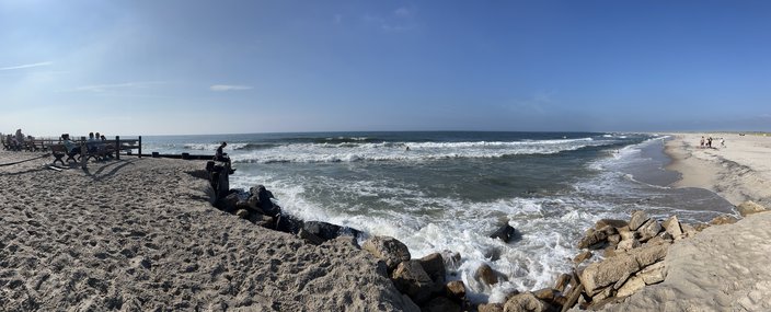
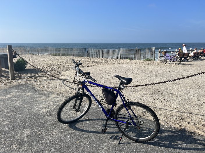
At the far south end, you'll reach a beach in Holgate. It's a scenic spot to stretch out your legs, maybe take a dip if you're into that, or watch some surfers.
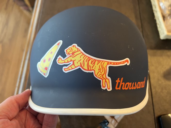
I also took a picture of my bike at this spot, since some of you asked what I was riding after my initial review of Longport/Margate/Ventnor/AC.
Please note the sweet horn. Here's my helmet. The front, with a tiger jumping after a slice of pizza:
And the back. If I pass you, you have to look at that lightning bolt like, "You just got smoked!"
If you see me, please feel free to yell at me, like this guy did today:
I’ve never seen a human being more confused than @JimmyKempski when I screamed “Ayo Jimmy” as I passed him during his bike ride.
— Zach Siskind (@ZachSiskind) July 4, 2023
Sorry man, I don’t know what came over me.
For our post-biking meal, I went to Dockside Diner. I had the cinnamon bun pancakes, sausage links, and bacon, thus pretty much consuming all the calories I had just burned, and then some. It was good, though. I ate for America.
Grade
The south end is a good ride that I have done many, many, many times, and there's always a lot of people/dog watching along the way. If there is one recommendation I would make, it would be to go against the wind first, so that the way back is easier. If you're not super fit, you do not want to be on mile 20 pedaling into a steady 15 MPH wind. Overall, I'd give it 7/10 bikies.
🚲 🚲 🚲 🚲 🚲 🚲 🚲
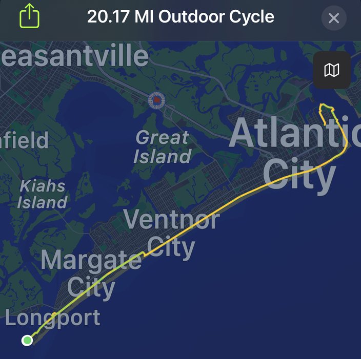
First, the route and the stats:
• Time: 2:05:09
• Distance: 20.17 miles (total, up and back)
• Total calories: 898
• Active calories: 631
• Average speed: 9.6 MPH 🐌
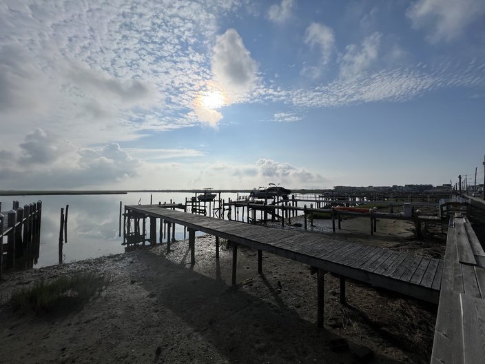
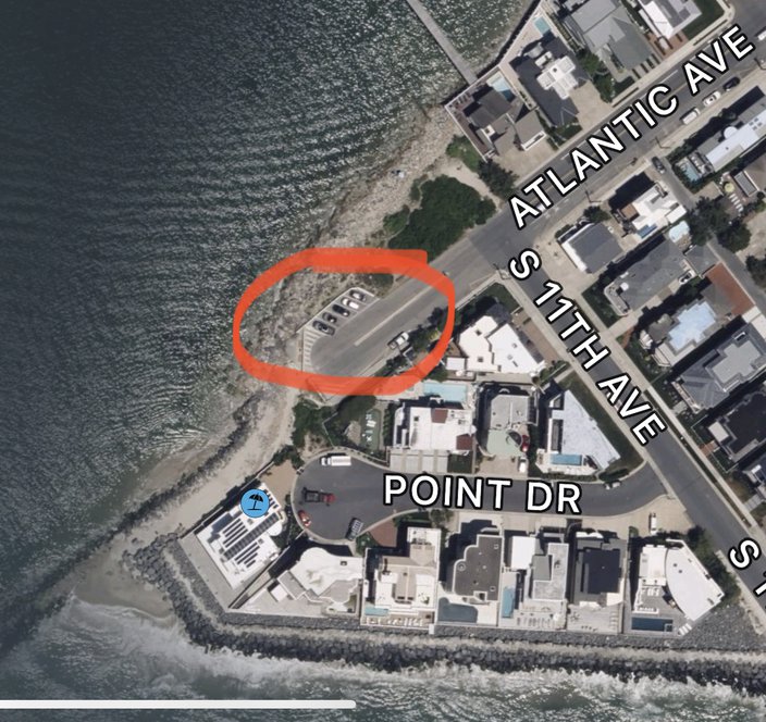
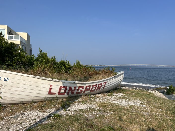
I started in Longport, bright and early, and found parking at the southern tip of the island. I imagine these spots fill up quickly and are hard to get, but I was lucky.
See the jetty that goes out into the water on the bottom left side of that picture☝️? I walked all the way out basically as far as I could go, and almost ate it on an extremely slippery rock, so be careful if you're an idiot like me. But there's a little beach area just past this big, decorative lifeguard boat to either fuel up before the ride or wind down after it.
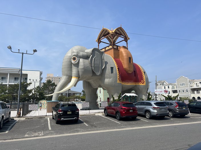
Longport has a nice, sizeable bike lane on Atlantic Ave., which continues when you head north into Margate, an underrated shore town, in my opinion. In Margate you will of course come across Lucy the Elephant.
You might ask, "Wtf is that?" Well, here you go.
The ride from Longport to the start of the Margate/Ventnor/AC boardwalk is only about 3 miles to Martindale Ave., the first possible street you can turn onto to reach the boardwalk. I did indeed turn onto Martindale and rode the boardwalk the rest of the way.
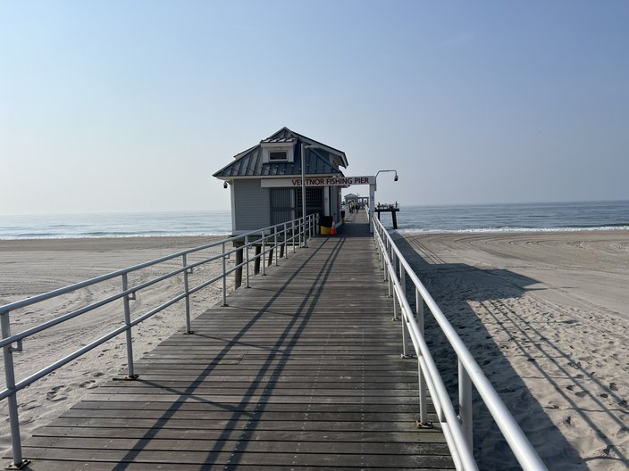
In Ventnor you'll reach the Ventnor Fishing Pier.
It was indeed a pier, and people were fishing. If you look down the pier in the picture above you can squint and see a gate. That gate is situated about halfway down the pier. If you want to go through the gate and all the way down to the end of the pier, you have to pay, because, uh... 🤷♂️. That's dumb. The gate is ugly and lame. (If you're a Ventnor resident and have a good reason why that gate is there, I'm not interested in hearing it, thank you in advance.)
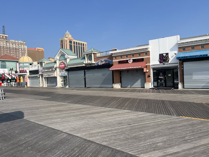
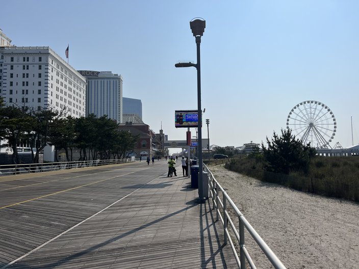
Heading into Atlantic City, there's a lot to look at, whether it's weirder areas, like the famed Psychic Reading District...
Or the parts where there are casinos on the left and the Steel Pier on the right...
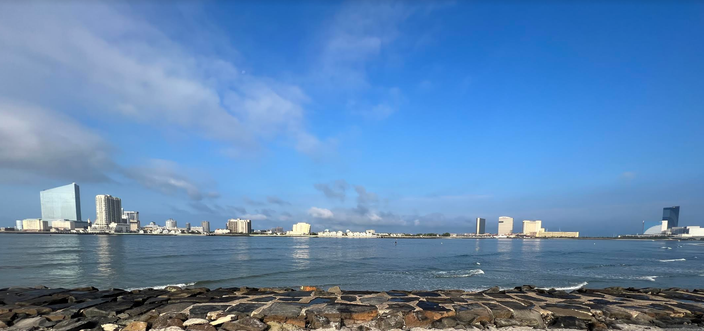
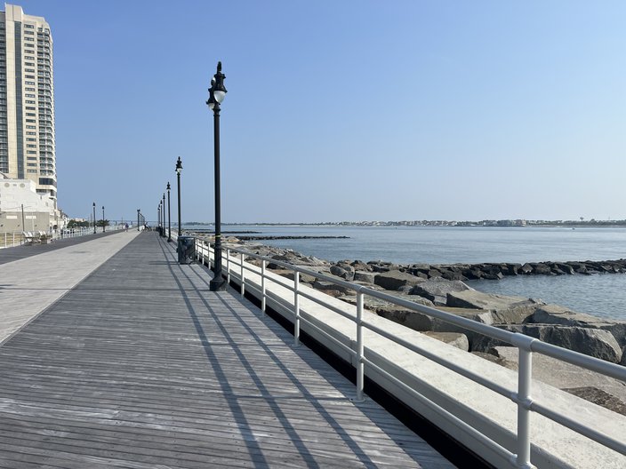
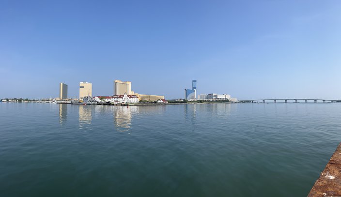
Atlantic City has a reputation for being this gritty, run-down, ugly town, and that is certainly deserved, but I have to say that it was kinda pretty along the boardwalk early in the morning on a bike, particularly on the north end by the jetties...
And views like this were kinda cool...
After I rode back all the way back to the car in Longport, I went to Ventura's in Margate, which has beach views. I had a bushwacker and a burger, both delicious.
Gripes:
• I was on the boardwalk for like 12 miles, I'd say. Something like that. After a while, you will eventually feel constant rattling of the tires on the boardwalk wood on your hands. They'll get sore. Man, I sound like a baby.
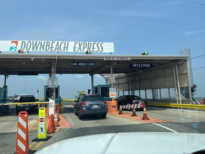
• On the drive off of the island, Waze took me a different way than the way I came in, and I came across this...
WTF is that?!?!? You have to pay to leave? And there's no EZ Pass?!? What is this, 1982? G. T. Capital F. O. H. I only had to wait for a half dozen or so cars, but what is it like there on a Saturday in July? It has to be just awful, right? And it's $2.25? Lol. Like, it can't just be a round number? (Again, if you're a resident of this area and have what you believe is a good reason for that toll to exist, I'm not interested in hearing it.)
Grade
Longport, Margate, and Ventnor are all super nice towns, and as noted above, there's a lot to look at riding along on the Atlantic City Boardwalk. Bathrooms are plentiful, you barely have to deal with any cars at all, and you can very easily hop off the path at almost any time and quickly find food or drinks.
Good times were had, and I give this ride an enthusiastic 9/10 bikies.
🚲 🚲 🚲 🚲 🚲 🚲 🚲 🚲 🚲
Follow Jimmy & PhillyVoice on Twitter: @JimmyKempski | thePhillyVoice
Like us on Facebook: PhillyVoice Sports
Add Jimmy's RSS feed to your feed reader