February 16, 2024
 Jon Tuleya/PhillyVoice
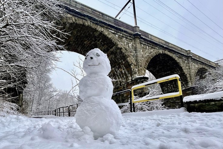
The National Weather Service says much of the region could see up to 5 inches of snow by Saturday. This photo taken Jan. 19, 2024, shows a snowman made during last month's storm, standing at the Wissahickon Creek trailhead near Ridge Avenue.
A storm traveling from the Midwest is due to reach the East Coast by overnight Friday into Saturday, and it could deposit nearly a half a foot of snow on much of Southeastern Pennsylvania and parts of South Jersey.
The National Weather Service has issued a winter weather advisory for Bucks, Chester, Delaware, Montgomery and Philadelphia counties starting at 10 p.m. Friday and going into 10 a.m. Saturday. All of South Jersey — including the counties at the shore — are under a similar advisory.
It will be snowing in most of the region by 1 a.m. Saturday, and most areas should expect 3 to 4 inches of snow overnight.
Mike Lee, a meteorologist at the NWS office in Mt. Holly said the snow is expected to continue until between 8 a.m. and 10 a.m. on Saturday. Most area will get about another inch of snow by 10 a.m., though some places could see as much as 2 inches.
The NWS and the Philadelphia Office of Emergency Management advise those traveling late Friday in Saturday to heed extra caution due to potentially slippery conditions. The snow could stick around for a couple of days, Lee said, depending on temperatures during the daytime hours. The temperature in most of the region will top out at 38 degrees Saturday but then dip down to 22 degrees that night.
But by Wednesday and Thursday next week, the high temperature could reach 50 degrees.
Current predictions show 2-4” of snow possible, beginning tonight and continuing through early Saturday morning before the system moves out. Hazards include slippery road conditions. Use caution traveling. Follow the forecast. https://t.co/PuQ22ZuKtu
— Philadelphia OEM (@PhilaOEM) February 16, 2024
Philadelphia's Office of Homeless Services declared a Code Blue that has been in effect since 3 p.m. Friday, and the city will take extra measures to get people who are homelessness to shelters. The Code Blue will be in effect from Friday at 3 p.m. until Tuesday at 9 a.m.
Philadelphia was mostly spared by the storm that passed through Monday night into Tuesday morning. Less than an inch of snow fell on most of the city and it quickly melted from paved surfaces. However, suburban areas like Chester County got between 3 to 10 inches of snow.
Here's the NWS forecast for Center City, as of Friday evening:
FRIDAY: Snow, mainly after 1 a.m. Low temperature around 30. Chance of precipitation is 100%; 3 to 5 inches of snow possible.
SATURDAY: Snow showers likely before 10 a.m. and then a slight chance of snow until 1 p.m. Additional accumulation of snow about an inch. Cloudy, then mostly sunny. High near 38, low around 23.
SUNDAY: Sunny, with a high near 40, overnight low around 20. Winds could reach 20 mph during the day.
MONDAY: Sunny. High near 44, low around 26.
TUESDAY: Mostly sunny. High near 47, low around 30.