


April 21, 2015
Have four hours to spare?
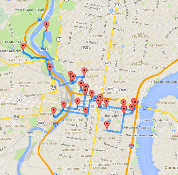
Randy Olson, a fourth-year computer science graduate research assistant at Michigan State University, used data analysis to map out an optimized walking tour of Philadelphia.
If you’re anything like me whenever you stop in a big city, you have a few main attractions that you’d like to visit and end up haphazardly spending half your day staring at maps and trying to figure out the public transit system.
However, by focusing on a limited few attractions, we’re missing out on dozens of interesting places that we could’ve visited along the way. This is where the route optimization algorithm can come into play again: If we hand the algorithm the list of popular attractions in a city, it can provide us an efficient walking tour around the city that hits all of those attractions.
The 12-mile route encompasses some of the best sights the city has to offer. Some attractions include Fairmount Park, the Philadelphia Zoo, the Rocky steps, Reading Terminal Market and more.
Click here for an interactive map or see the Google Maps walking directions: [1] [2] [3]
Olson also mapped out an optimized walking tour of New York City.