


November 30, 2017
 Source/U.S. Geological Survey
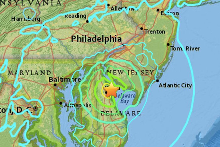
The U.S. Geological Survey shake map from Thursday's 5.1-magnitude earthquake in Delaware Bay.
Residents across the Mid-Atlantic region experienced a brief but distinct shaking sensation late Thursday afternoon, an event the US Geological Survey has confirmed was a 4.1-magnitude earthquake along the coast of the Delaware Bay.
The yellow star marks the center of the 4.1-magnitude earthquake in Delaware Bay, just south of the mouth of the Delaware River. At bottom right is Dover Air Force Base, about five miles southeast of the quake's center.The earthquake occurred about 53 miles south of Philadelphia at a coastal site along the Delaware Bay, according to the USGS. An initial seismographic recording around 4:47 p.m. called the quake 4.4-magnitude, but the recording at is epicenter was listed as a 5.1.-magnitude. The USGS appeared to lower it again to 4.4 about 30 minutes after it struck, and then again to 4.1 an hour after the event. 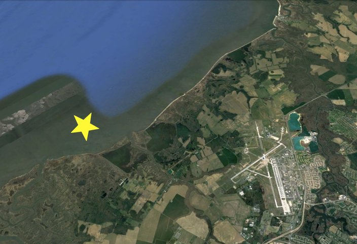 Source/GoogleEarth
The quake was felt from as far south as Washington, D.C., and north to New York City and as far west as the eastern West Virginia, according to eyewitness reports filed with the USGS.
It was felt as a slight shaking in office buildings in Center City Philadelphia.
Reactions poured in almost instantly on social media as people across the region confirmed the event.
The largest earthquake to hit Philadelphia in recent memory was in 2011, when a 5.8 magnitude quake centered in Virginia sent tremors through the city and was felt from Georgia to Canada.
Check back for updates on this developing story.