


May 29, 2015
 Visit Bucks County/for PhillyVoice
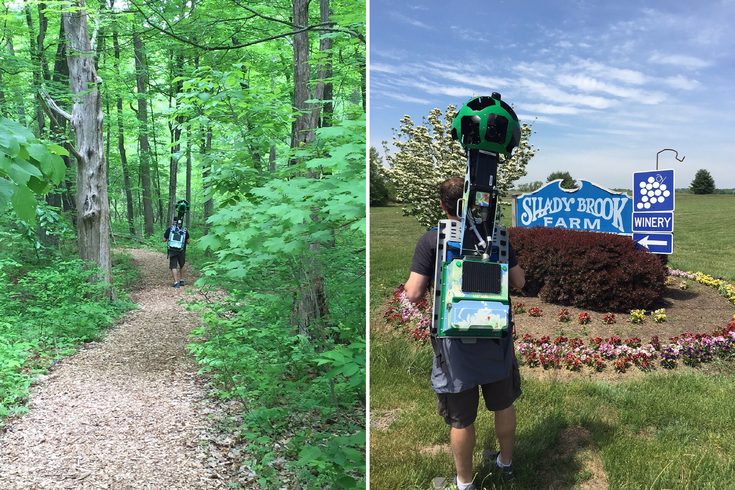
The Trekker team records Bowman's Hill Wildflower Preserve (left) and Shady Brook Farm (right).
If you've ever used Google Maps Street View, you know it lets you visually explore locations around the world without leaving your office chair. But, until now, Google has kept Street View to, well, the streets. With the Street View Trekker program, the company's helping users discover off-road experiences, and Bucks County has been chosen to participate.
After agreeing on 12 locations to shoot, Google loaned Visit Bucks County, the region's tourism organization, a hefty set of equipment. The pack, which VBC Vice President and Head Trekker Paul Bencivengo estimated weighs 50 pounds, holds 15 cameras that take panoramic views of each site as the trekker walks around. Images are saved in a hard drive that VBC will send to Google at the end of the loan. They'll then be stitched into an immersive, interactive experience much like what Google's done with the Pyramids of Giza or Venice, Italy.
Tourists and residents should keep an eye out for Bencivengo and crew - and maybe offer them a drink of water. So far they have trekked through Bowman’s Hill Wildflower Preserve and Bowman’s Tower, Shady Brook Farm, Washington Crossing Historic Park, Tyler State Park, Sand Castle Winery and Ringing Rocks Park. Weather permitting, Peace Valley Lavender Farm, Core Creek Park, Nockamixon State Park, Peace Valley Park, Neshaminy State Park and the Delaware Canal will be covered in the coming weeks.