


December 02, 2017
 Source/National Oceanic and Atmospheric Administration
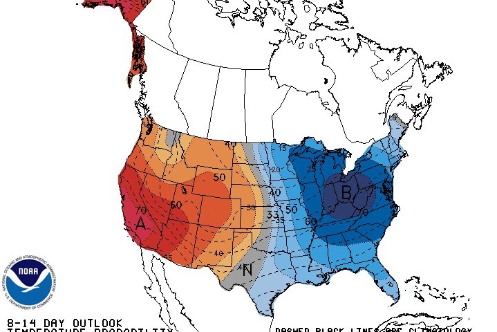
Starting late next week, it'll feel a lot like winter again in the Philadelphia region.
Knock out the rest of your holiday shopping while you still can. These mild days of early December won't be around for much longer.
Temperatures are first expected to climb again in the next several days – National Weather Service forecasts are showing a high of 61 on Tuesday – before the coldest air of the season thus far settles over the area late next week.
The Midwest will receive the brunt of the blast, but the cold air will reach much of the East Coast by mid-December, Accuweather reported.
Philly can expect highs to reach the low 40s by late next week, followed by "true arctic air" set to keep much of the Northeast and South cold through the middle of the month.
A flip to more typical December weather is still on the way. We had some cold weather earlier in November, so you probably still have your coat handy. May now be time to excavate out the snow shovel from the stuff piled in front of it. Just to be prepared. pic.twitter.com/DMjsJ84TEf
— Gary Szatkowski (@GarySzatkowski) December 2, 2017
National Weather Service meteorologist Paul Head told Pennlive.com that the cold air is tracking from Siberia through the North Pole and into Canada.
"We're gonna just see a slow, gradual cooldown after Tuesday," Head told the site. "This type of air mass comes in in stages."
Can we expect any snow to accompany the cold spell?
Per the Accuweather report:
The jet stream pattern will hold the key as to whether moisture-rich storms can strengthen and sweep northeastward from the South Central states with rain and snow or remain weak and drift eastward across the Gulf of Mexico with spotty showers.
The jet stream is a high-speed river of air at the level where jets cruise. The jet stream provides a highway for storms and cold air to take.
Even if a northwesterly flow persists with the jet stream, Alberta Clipper storms may bring quick episodes of light snow into part of the Northeast.
Should major storms come calling, brief warmups would occur over the Southeastern states along with the potential for severe weather.
The report can be found here.