


December 15, 2017
 Thom Carroll/PhillyVoice
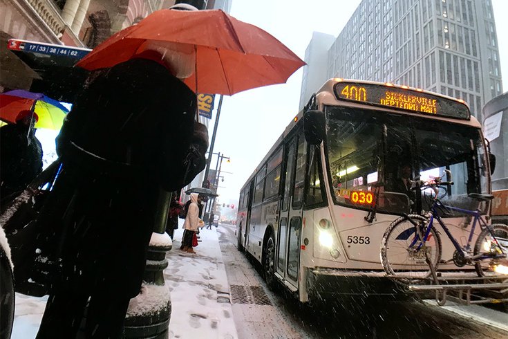
Commuters wait in the snow at a bus stop near 12th and Market streets in Center City Philadelphia on Dec. 15, 2017.
The snow has arrived and forecasters are warning about the impact it could have on the busy Friday evening, pre-holiday commute.
The timing of the storm and the cold temperatures more than the expected accumulation is causing the concern.
RELATED READ: Here's an early, early Christmas weather forecast for Philly
A winter weather advisory is in effect through 9 p.m., according to the National Weather Service.
The snow started light around 12:30 p.m., a bit earlier than expected, in the Philadelphia region and is expected to taper off around 9 p.m.
Nearly two hours after it started, Center City streets and sidewalks were mostly just wet.
This morning, the weather service predicted about 3 or 4 inches of snow, but this afternoon scaled back that accumulation to about 2 inches before the storm moves out, according to forecasters.
The heaviest snow is expected to end by 4 or 5 p.m., as commuters are heading home from work or straight to the mall for Christmas shopping.
Temperatures are expected to hang around 27 degrees.
Due to the sub-freezing temperatures, snow was expected to stick to untreated roads and sidewalks, and possibly even highways in those places where the heaviest snow falls, forecasters said. Those slippery conditions, as well as reduced visibility in many places, will make driving hazardous.
In Philadelphia, the Streets Department is preparing for the storm, with 85 trucks and more than 45,000 tons of salt available. Salting of roads will not begin until the snow arrives.
The city's Office of Homeless Services Code Blue declaration remains in effect until 10 a.m. Monday. Teams will patrol the streets in greater numbers, urging homeless people to come to local shelters. People do not need ID to enter Code Blue shelters or cafes from the street, and they can remain indoors throughout the duration of the Code Blue. If you are concerned about someone who is homeless, please call the Outreach Coordination Center at 215-232-1984 at any time. Outreach is available 24/7. First responders can also transport people to shelter for their own safety.
Just ahead, there is some consolation. Temperatures will moderate Monday and Tuesday, with high temperatures in the 50s.
Here is the 7-day forecast from the weather service:
Friday afternoon: Snow, mainly after 4 p.m. High near 31. Light and variable wind. Chance of precipitation is 80 percent. Total daytime snow accumulation of 1 to 2 inches possible.
Friday night: Snow likely, mainly before 9 p.m. Cloudy during the early evening, then gradual clearing, with a low around 25. Light northwest wind becoming west 5 to 10 mph in the evening. Chance of precipitation is 60 percent. New snow accumulation of less than one inch possible.
Saturday: Increasing clouds, with a high near 39. West wind 8 to 13 mph.
Saturday night: Mostly cloudy, with a low around 27. West wind 5 to 7 mph becoming calm in the evening.
Sunday: Mostly sunny, with a high near 42. Calm wind.
Sunday night: A slight chance of rain after 8 p.m. Mostly cloudy, with a low around 34. Chance of precipitation is 20 percent.
Monday: Mostly sunny, with a high near 50.
Monday night: Mostly cloudy, with a low around 37.
Tuesday: Partly sunny, with a high near 52.
Tuesday night: Partly cloudy, with a low around 35.
Wednesday: Sunny, with a high near 44.
Wednesday night: Mostly clear, with a low around 28.
Thursday: Mostly sunny, with a high near 45.